
In the modern era of rapid urbanization and massive infrastructure development, the question “what is a geotechnical” is no longer just a query for civil engineers or geologists. In the context of the 21st-century tech landscape, geotechnical engineering has evolved into a high-tech discipline that merges traditional earth sciences with cutting-edge software, artificial intelligence, and sophisticated sensor networks. At its core, geotechnical technology refers to the suite of digital tools and hardware used to understand, model, and monitor the behavior of earth materials.
As we build taller skyscrapers, deeper tunnels, and more resilient smart cities, the “tech” in geotechnical has become the primary driver of safety and efficiency. This article explores the digital transformation of this field, moving from manual soil sampling to the sophisticated technological ecosystem that defines modern subterranean exploration.
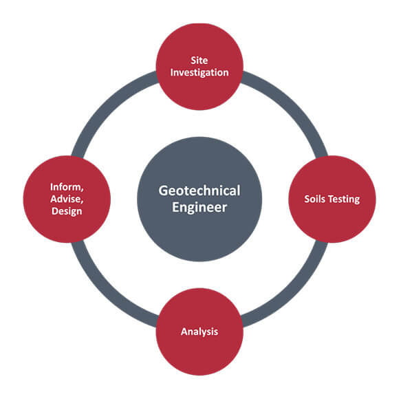
The Evolution from Manual Observation to Geotechnical Technology
Historically, geotechnical work was a labor-intensive process defined by physical samples and empirical formulas. Today, the field has undergone a radical digital shift, integrating Information Technology (IT) into every layer of site investigation and analysis.
Defining the Modern Geotechnical Tech Stack
The modern geotechnical professional utilizes a “tech stack” that rivals that of a software developer. This includes high-precision Field Data Collection (FDC) apps, Geographic Information Systems (GIS), and cloud-based databases. Instead of paper logs, engineers use tablets equipped with GPS and specialized software to record soil strata in real-time, ensuring that data is synchronized instantly with central servers. This connectivity reduces human error and accelerates the decision-making process for multi-billion dollar construction projects.
The Shift from Manual Sampling to Digital Intelligence
While the physical act of drilling remains necessary, the intelligence derived from those samples is now purely digital. Advanced laboratory testing equipment is now fully automated and integrated with software that performs complex stress-strain calculations as the test progresses. This transition from manual data entry to automated digital intelligence allows for a higher resolution of data, enabling engineers to identify microscopic anomalies in soil structure that could lead to macroscopic failures, such as landslides or foundation settlement.
Software Ecosystems: Modeling the Unseen
Perhaps the most significant technological leap in the geotechnical field is the development of sophisticated modeling and simulation software. Because we cannot “see” what is happening hundreds of feet below the surface, we rely on digital representations to predict how the ground will react to heavy loads or seismic events.
Finite Element Analysis (FEA) and Numerical Modeling
Software packages like PLAXIS, GeoStudio, and RS3 have revolutionized the way we approach earth-structure interaction. These tools utilize Finite Element Analysis (FEA) to simulate complex scenarios—such as the construction of a deep basement in a crowded urban environment or the stability of a dam during an earthquake. By creating a digital mesh of the subsurface, these programs can run thousands of iterations to determine the “Factor of Safety,” allowing tech-driven firms to optimize material usage and reduce construction costs without compromising safety.
Building Information Modeling (BIM) Integration
The integration of geotechnical data into Building Information Modeling (BIM) is a major trend in construction technology. Traditionally, the “ground” was a blank space in a structural model. Today, “Geotechnical BIM” allows for 3D subsurface models to be imported directly into the broader project design. This enables “clash detection” between underground utilities and geological features long before a shovel touches the ground. The ability to visualize the underground in 3D alongside the proposed structure represents a pinnacle of digital engineering.
Cloud Computing and Data Centralization
Geotechnical projects generate massive amounts of data, from borehole logs to laboratory results. Cloud-based platforms like Bentley’s OpenGround or Seequent’s Central allow global teams to collaborate on a single “source of truth.” In the past, data silos led to catastrophic engineering failures; today, cloud computing ensures that a structural engineer in London and a geotechnical consultant in New York are looking at the exact same, real-time updated geological model.
The Impact of AI and Machine Learning on Geotechnical Analysis
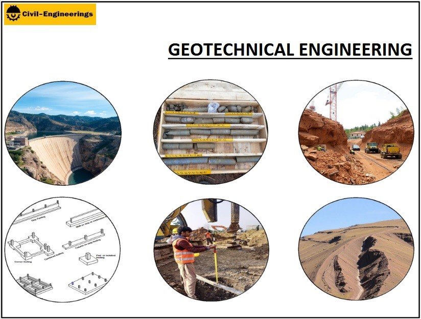
Artificial Intelligence (AI) and Machine Learning (ML) are no longer futuristic concepts; they are actively being deployed to solve some of the most complex problems in earth science.
Predictive Analytics for Geological Risk
One of the most promising applications of AI in the geotechnical niche is predictive analytics. By feeding decades of historical borehole data and seismic records into machine learning algorithms, researchers can now predict areas at high risk for soil liquefaction or slope instability with unprecedented accuracy. These AI models can identify patterns in soil behavior that are too subtle for the human eye or traditional mathematical models to detect.
Automating Subsurface Mapping
Machine learning is also being used to automate the interpretation of Geophysical data. Techniques such as Ground Penetrating Radar (GPR) and Electrical Resistivity Tomography (ERT) produce complex data sets that used to take weeks to interpret. Modern AI tools can process these signals in minutes, automatically identifying underground voids, buried utilities, or changes in bedrock depth. This automation significantly reduces the “uncertainty” that has historically plagued geotechnical engineering.
IoT and the Rise of Real-Time Subsurface Monitoring
The “Internet of Things” (IoT) has extended its reach deep into the earth. Modern geotechnical technology relies on a web of interconnected sensors that provide a continuous heartbeat of a site’s health.
Smart Sensors and Wireless Telemetry
The days of an engineer visiting a site once a month to read a manual gauge are over. Today, we use “smart” piezometers, inclinometers, and strain gauges equipped with wireless telemetry. These devices are embedded in retaining walls, tunnels, and slopes, transmitting data via LoRaWAN, cellular networks, or satellite to a central dashboard. If a slope moves by even a few millimeters, the system triggers an automated alert, allowing for evacuations or structural reinforcements before a failure occurs.
Digital Twins for Infrastructure
The ultimate expression of geotechnical IoT is the “Digital Twin.” A Digital Twin is a virtual replica of a physical asset (like a bridge or a dam) that is continuously updated with real-time sensor data. In the geotechnical context, this means having a digital model of the soil-structure interface that reacts in real-time to changes in groundwater level, loading, or vibration. This allows for “predictive maintenance,” where repairs are performed based on data-driven triggers rather than arbitrary schedules, saving millions in operational costs.
Future Trends: Robotics and Digital Security in Earth Engineering
As we look to the future, the geotechnical field is set to become even more automated and tech-centric, bringing with it new opportunities and challenges in the digital space.
Autonomous Drilling and Robotics
The next frontier in geotechnical technology is the deployment of autonomous drilling rigs and sub-surface robots. Companies are currently developing robotic “moles” equipped with sensors that can map soil conditions while tunneling, providing a continuous stream of data without the need for traditional boreholes. These robots use computer vision and tactile sensors to navigate the underground, much like a self-driving car navigates a highway.
Cyber-Physical Security in Geotechnical Infrastructure
With the rise of IoT and connected sensors, the geotechnical sector must now grapple with digital security. If a hacker were to gain access to the sensor network of a major dam or a metropolitan tunnel system, they could potentially falsify data or disable early-warning systems. As geotechnical data moves to the cloud, “Cyber-Physical Security” is becoming a critical sub-niche. Engineers must now be well-versed in encryption, secure data transmission protocols, and the protection of critical infrastructure from digital threats.
Resilience Through Tech
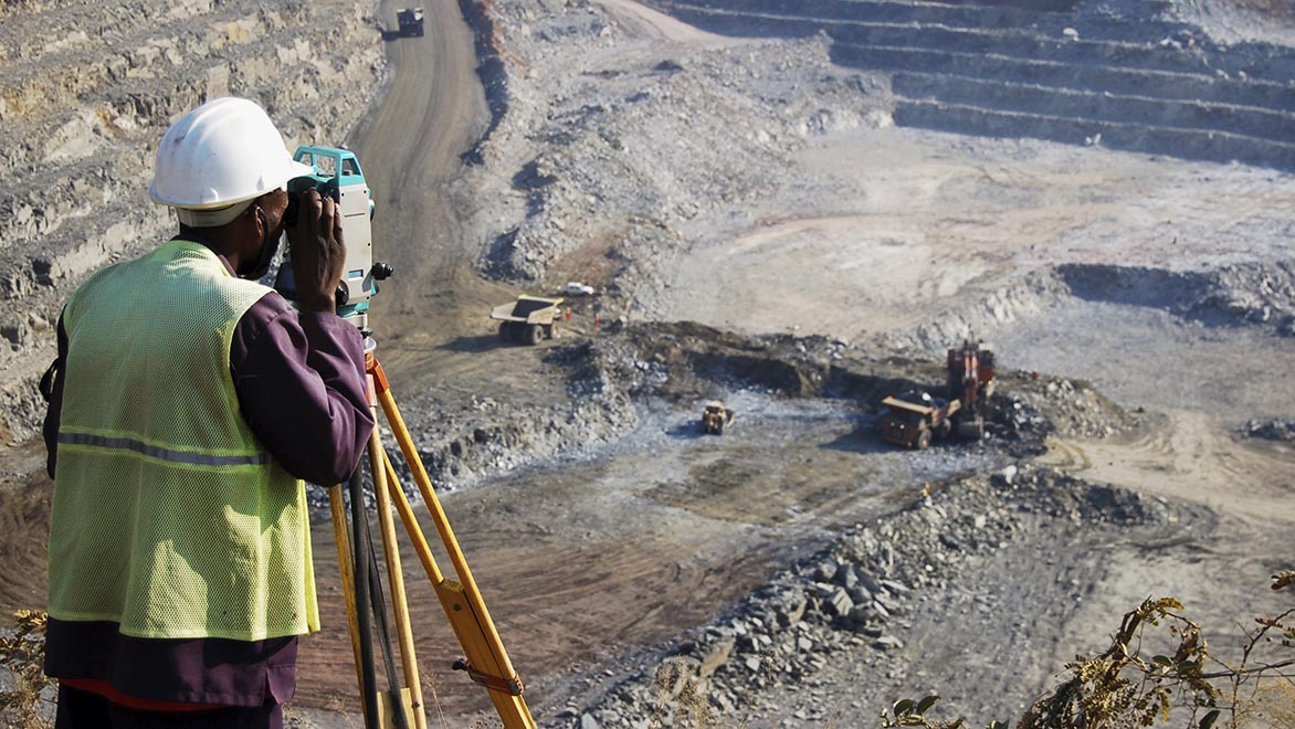
Ultimately, “what is a geotechnical” in the tech niche is a question of resilience. Through the application of advanced software, AI, and IoT, we are building a more resilient world. We are moving away from a reactive stance—fixing things after they break—toward a proactive, data-driven approach. The technology of the earth is no longer just about soil; it is about the sophisticated digital systems that allow us to inhabit that soil safely and sustainably.
By embracing these technological advancements, the geotechnical industry has transformed from a traditional engineering discipline into a vital component of the global tech ecosystem. Whether it is through the use of digital twins to monitor our cities or AI to predict natural disasters, the intersection of earth science and technology remains one of the most exciting and impactful frontiers of the modern digital age.
aViewFromTheCave is a participant in the Amazon Services LLC Associates Program, an affiliate advertising program designed to provide a means for sites to earn advertising fees by advertising and linking to Amazon.com. Amazon, the Amazon logo, AmazonSupply, and the AmazonSupply logo are trademarks of Amazon.com, Inc. or its affiliates. As an Amazon Associate we earn affiliate commissions from qualifying purchases.