In the popular imagination, storm chasing is often characterized by high-speed pursuits through the Great Plains, driven by adrenaline and a cinematic sense of danger. However, in the modern era, storm chasing has transitioned from a risky hobby into a sophisticated, tech-driven discipline. At its core, modern storm chasing is the mobile deployment of advanced meteorological technology designed to observe, record, and analyze atmospheric phenomena in real-time. It is a field defined by high-bandwidth data streams, satellite imagery, and the integration of artificial intelligence into predictive modeling.
Understanding what storm chasing is today requires looking past the windshield and into the array of monitors and sensors that populate a chaser’s vehicle. It is an exercise in applied data science, where the goal is to bridge the gap between theoretical weather models and the ground-truth reality of supercell thunderstorms.
The Digital Backbone: Data Acquisition and Visualization Software
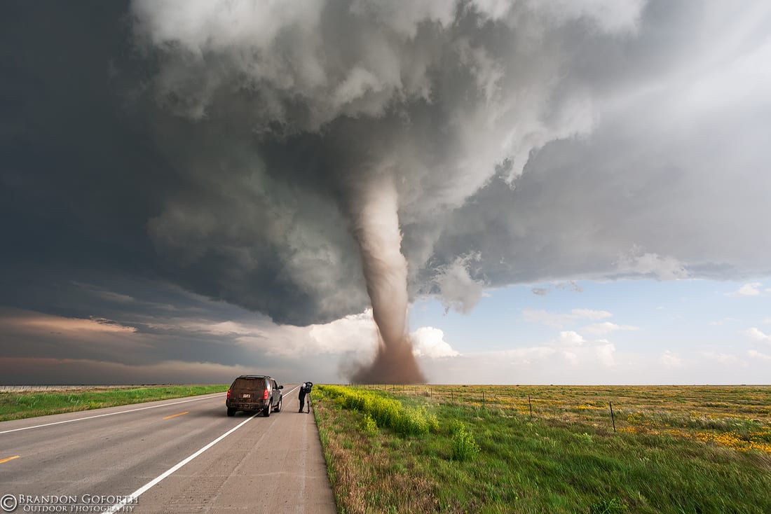
The most significant shift in storm chasing over the last two decades is the transition from “visual chasing”—relying on the naked eye and a radio—to data-centric interception. Today’s chasers are essentially mobile data centers, utilizing a suite of software tools to interpret complex atmospheric signals.
Dual-Polarization Radar and Mobile Visualization
The cornerstone of any modern storm chase is the NEXRAD (Next-Generation Radar) network. Chasers utilize software such as GRLevel3 or Gibson Ridge to visualize base reflectivity and velocity. The introduction of Dual-Polarization (Dual-Pol) technology has been a game-changer. By transmitting and receiving pulses in both horizontal and vertical orientations, chasers can now distinguish between heavy rain, hail, and “non-meteorological echoes”—specifically, the “Tornado Debris Signature” (TDS). This allows chasers to confirm a tornado’s presence on the ground even at night or when rain-wrapped, purely through digital signal processing.
Real-Time Data Integration Platforms
To make sense of the noise, chasers use sophisticated integration platforms like RadarScope or specialized GIS (Geographic Information Systems) mapping. These tools overlay GPS positioning with high-resolution radar data, lightning strike frequency, and surface observations. The tech allows for “nowcasting,” the ability to predict where a storm will be in 15-minute increments. By integrating cell tower data and satellite feeds, chasers can maintain a 3D visualization of the storm’s structure, identifying the “hook echo” and the “bounded weak echo region” (BWER) with surgical precision.
Hardware in the Field: Instrumentation and Vehicle Engineering
While software provides the map, hardware provides the bridge to the physical environment. The “tech” of storm chasing includes the physical modifications to vehicles and the deployment of specialized atmospheric sensors that provide data points that fixed weather stations cannot capture.
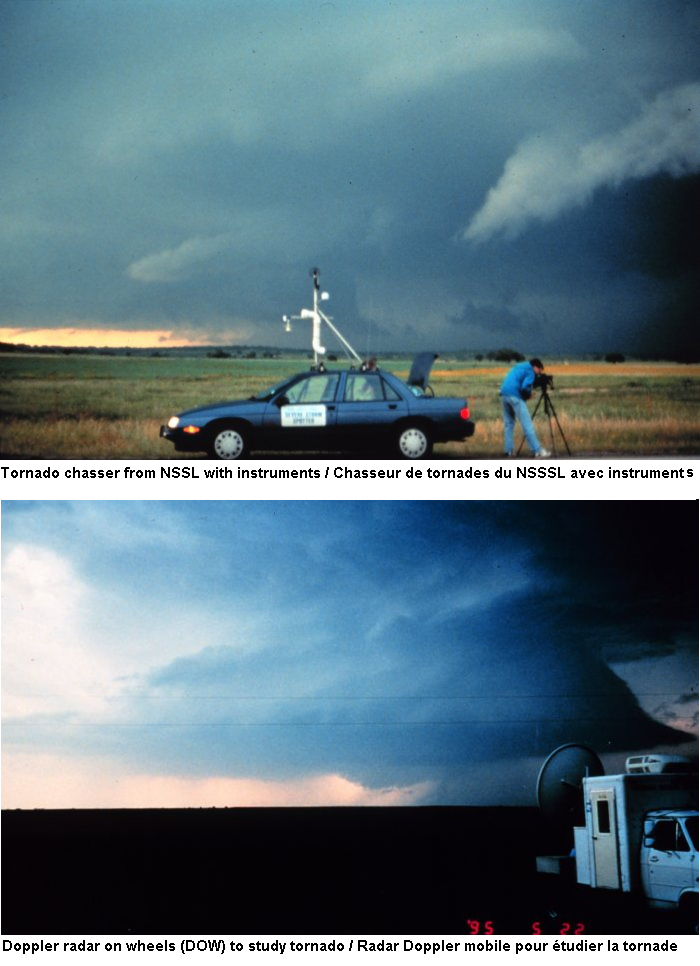
Mesonet Systems and In-Situ Probes
Modern chase vehicles are often equipped with mobile “Mesonets”—arrays of sensors mounted to the roof that measure temperature, humidity, wind speed, and barometric pressure at one-second intervals. This data is critical for identifying the “dryline” or the “outflow boundary,” the invisible triggers for storm development.
Furthermore, some research-oriented chasers deploy “turtles” or in-situ probes. These are aerodynamic, low-profile sensor pods designed to be placed directly in the path of a tornado. They utilize hardened solid-state memory and high-frequency barometers to record the extreme pressure drops within the vortex, providing data that helps engineers understand how to build more wind-resistant structures.
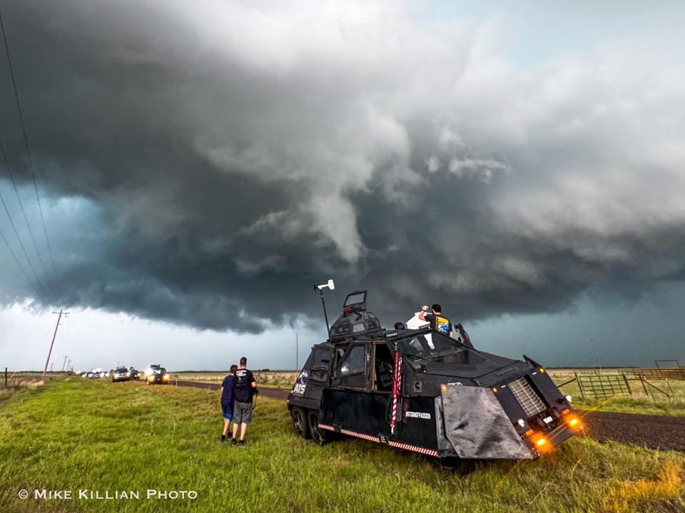
Engineering Survival: The Dominator and TIV Philosophy
In the niche of “intercept” chasing, the technology shifts from observation to structural engineering. Vehicles like the Dominator or the Tornado Intercept Vehicle (TIV) are marvels of mechanical tech. These vehicles feature 16-gauge steel plating, bulletproof polycarbonate windows, and hydraulic systems that lower the chassis to the ground to prevent wind from getting underneath. The tech involved includes infrared night-vision cameras for visibility in low-light environments and anemometers capable of measuring 200+ mph winds without shearing off. These vehicles represent the extreme end of how technology is used to penetrate environments previously deemed inaccessible to human observation.
The Role of Artificial Intelligence and Predictive Modeling
The “chase” begins long before the engine starts. It begins with high-performance computing (HPC). The ability to identify which part of a state is most likely to produce a significant tornado relies on complex numerical weather prediction (NWP) models.
Machine Learning in Supercell Identification
Meteorologists and tech-savvy chasers are increasingly turning to machine learning (ML) algorithms to sort through vast datasets. Traditional models like the HRRR (High-Resolution Rapid Refresh) provide hourly updates on atmospheric conditions, but AI is now being trained to recognize patterns in “hodographs” (vector representations of wind shear). By comparing current conditions against decades of historical storm data, AI can assign a probability score to specific convective cells, helping chasers ignore “junk” storms and focus on those with the highest rotational potential.
Improving Lead Times with Cloud-Based Simulation
The move to cloud computing has democratized access to high-tier modeling. Chasers can now run “ensemble” models on tablets, viewing dozens of different atmospheric simulations simultaneously. This “probabilistic” approach allows for better decision-making. If 40 out of 50 model runs suggest a specific county will see storm initiation, the chaser uses that tech-driven consensus to position themselves. This reduces the “carbon footprint” of chasing and increases the scientific yield of each mission.
Communication and the Internet of Things (IoT)
The isolation of the Great Plains was once a major barrier to storm chasing. Today, the “Internet of Things” has turned every chase vehicle into a node in a global information network. Connectivity is the most vital tech tool for safety and data sharing.
Satellite Connectivity and High-Bandwidth Field Comms
In the past, chasers frequently “went dark” when they entered rural areas with poor cellular coverage—often the exact locations where storms are most violent. The advent of Starlink and mobile satellite internet has revolutionized the field. High-bandwidth, low-latency satellite dishes mounted to chase vehicles ensure that radar updates never lag. This connectivity also enables the transmission of 4K livestreams, which are used by local news stations and the National Weather Service (NWS) for “ground truth” verification. This tech pipeline helps NWS forecasters issue more accurate warnings, as they can see the visual confirmation of what their radar is suggesting.
The Crowdsourcing of Meteorological Data
Social media and dedicated apps (like Spotter Network) have created a digital ecosystem of crowdsourced data. Using GPS-enabled reporting, chasers can “ping” their location and report weather sightings directly into the NWS workstations. This IoT integration means that a chaser’s observation of a “wall cloud” or “funnel” is instantly digitized and mapped, providing a real-time overlay for emergency managers. It is a massive, distributed sensor network that relies entirely on the synchronization of mobile tech and central databases.
The Future of Storm Chasing Technology
The future of storm chasing lies in the deployment of unmanned systems. We are already seeing a shift toward the use of “Storm Drones”—UAVs (Unmanned Aerial Vehicles) designed to fly into the inflow of a storm to take measurements at altitudes that manned vehicles cannot reach. These drones use LiDAR (Light Detection and Ranging) to map the wind field in 3D, providing a level of detail that was previously impossible.
As we look forward, the definition of “what is storm chasing” will continue to evolve. It will move further away from the “cowboy” imagery of the 1990s and closer to a high-tech discipline of mobile atmospheric sensing. Through the integration of AI, satellite communication, and advanced structural engineering, storm chasers are no longer just following the wind; they are mapping the very fluid dynamics of our atmosphere with an precision that saves lives and advances our understanding of the planet’s most violent weather.
In this context, storm chasing is the ultimate “field test” for technology. It is a high-stakes environment where software must not crash, hardware must not fail, and data must be delivered in milliseconds. It is, quite literally, the cutting edge of mobile tech.
aViewFromTheCave is a participant in the Amazon Services LLC Associates Program, an affiliate advertising program designed to provide a means for sites to earn advertising fees by advertising and linking to Amazon.com. Amazon, the Amazon logo, AmazonSupply, and the AmazonSupply logo are trademarks of Amazon.com, Inc. or its affiliates. As an Amazon Associate we earn affiliate commissions from qualifying purchases.