In the era of hyper-connectivity, we often overlook the invisible frameworks that allow our global digital economy to function. At the heart of logistics, e-commerce, and geospatial data lies a fundamental alphanumeric string: the postal or ZIP code. While a layman might view these as simple labels for mail delivery, in the world of technology, they are critical data points. They serve as the primary keys in massive databases, the variables in complex routing algorithms, and the foundation of modern Geographic Information Systems (GIS).
Understanding what a postal or ZIP code is from a technical perspective requires moving beyond the envelope. It requires an exploration of how physical space is digitized, categorized, and processed by machines to facilitate everything from high-frequency trading to autonomous drone delivery.
1. The Architecture of Locational Data: Defining the System
To understand the technical utility of these codes, one must first distinguish between the two most common terms used in spatial indexing. A “Postal Code” is the generic, international term for a series of letters or digits included in a user’s address to assist in the sorting of mail. A “ZIP Code,” which stands for Zone Improvement Plan, is a specific type of postal code used exclusively by the United States Postal Service (USPS), introduced in 1963 to automate mail processing.
From Paper to Pixels: The Digital Evolution
The transition of postal codes from physical sorting bins to digital databases changed their fundamental nature. In a database schema, a postal code acts as a “spatial attribute.” In the early days of computing, these codes were stored as simple strings. Today, they are linked to complex polygonal data. When you enter a ZIP code into a web application, the backend isn’t just looking at five digits; it is querying a database that associates those digits with a specific geometric shape defined by latitude and longitude coordinates.
Understanding the Syntax: Algorithms Behind the Strings
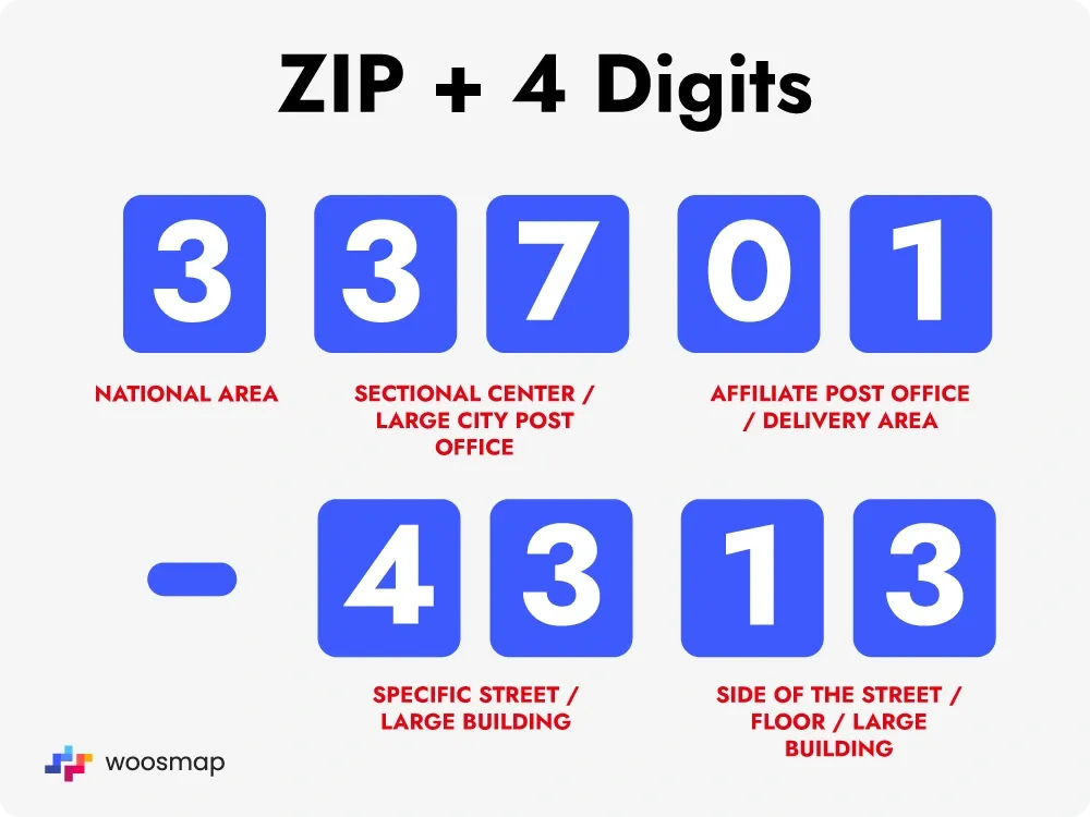
Different countries utilize different syntax for their coding systems, which presents a unique challenge for software developers building global platforms. For instance, the US uses a numeric 5-digit or 5+4 system, whereas the UK and Canada utilize alphanumeric strings (e.g., SW1A 1AA or K1A 0B1). From a software engineering standpoint, this requires robust validation logic and Regular Expressions (Regex) to ensure data integrity. A tech-savvy approach to postal codes involves “Input Masking” and “Standardization,” ensuring that a “90210” and a “90210-0001” are reconciled within the system to prevent data duplication.
2. Geocoding and Geospatial Intelligence
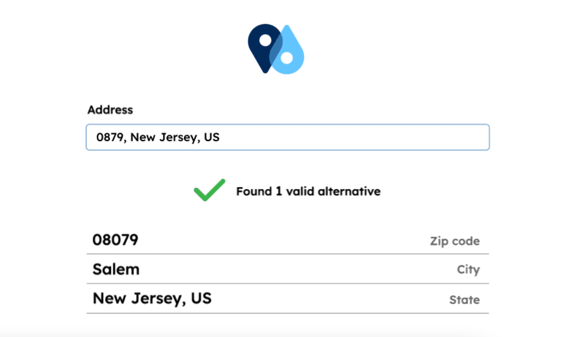
One of the most significant technological applications of postal codes is “Geocoding.” This is the process of transforming a description of a location—such as a ZIP code—into numerical coordinates (latitude and longitude) that can be plotted on a digital map.
The Role of Geographic Information Systems (GIS)
GIS technology relies heavily on postal codes to layer data. When a technology company wants to analyze market density, they use “Spatial Join” operations. This involves taking a dataset of users and overlaying it onto a map of postal code boundaries. These boundaries, however, are not static. In the US, ZIP code boundaries are defined by “ZIP Code Tabulation Areas” (ZCTAs), which are generalized representations created by the Census Bureau. Tech professionals must account for the fact that ZIP codes are actually linear routes for mail carriers, not perfect polygons, leading to complex algorithmic approximations in mapping software.
Reverse Geocoding and API Efficiency
Modern apps, such as Uber or DoorDash, often use “Reverse Geocoding.” When your phone’s GPS identifies your coordinates, the application’s API (Application Programming Interface) queries a database to find the corresponding postal code. This is essential for calculating local taxes, identifying the nearest service hub, or providing localized content. APIs like Google Maps Platform, Mapbox, and OpenStreetMap provide the heavy lifting here, translating raw satellite data into the human-readable postal codes that drive user interfaces.
3. The Engine of E-Commerce and Logistics Technology
The global e-commerce market would collapse without the sophisticated integration of postal codes into logistics software. These codes are the primary inputs for “Last-Mile Delivery” algorithms, which are often the most expensive and complex part of the supply chain.
Automating the Last Mile: Routing Algorithms
When a package is scanned at a distribution center, the postal code is read by high-speed Optical Character Recognition (OCR) systems. This data is then fed into a routing engine. Algorithms such as the “Traveling Salesperson Problem” (TSP) solvers use postal codes to group packages into optimal clusters. By analyzing the density of a specific ZIP code, the software can determine whether a van, a bike, or a walking courier is the most efficient means of delivery.
Big Data and Predictive Inventory Management
Tech giants like Amazon use postal codes for “Predictive Shipping.” By analyzing historical purchase data within specific postal codes, AI models can predict what products will be in high demand in those areas. This allows companies to move inventory to “sort centers” closer to those ZIP codes before a customer even clicks “buy.” In this context, the ZIP code becomes a unit of analysis for machine learning models to optimize the global flow of goods.
4. Security, Authentication, and the Digital Perimeter
Beyond logistics and mapping, postal codes serve as a vital component of digital security and financial technology (Fintech).
Address Verification Systems (AVS) in Fintech
Whenever you make an online purchase, the payment gateway uses an Address Verification System (AVS). The system checks the ZIP code provided during checkout against the ZIP code on file with the credit card issuer. This is a low-latency security check designed to prevent fraud. From a tech perspective, this involves an encrypted “handshake” between the merchant’s server and the bank’s API. If the ZIP code doesn’t match, the transaction is flagged or declined, providing a crucial layer of security in the “Card Not Present” (CNP) environment.
Cybersecurity and Data Privacy in Location Tracking
While postal codes are useful, they also pose challenges for data privacy. In the field of cybersecurity, ZIP codes are often considered “Personally Identifiable Information” (PII) when combined with other data points. Tech companies must use “Data Masking” or “K-Anonymity” techniques to ensure that individuals cannot be re-identified through their postal codes in large datasets. For developers, this means building systems that can analyze regional trends without compromising the specific location of a single user.
5. The Future of Spatial Indexing: Moving Beyond the Five-Digit Code
As we move toward a world of autonomous vehicles, drone deliveries, and smart cities, the traditional 5-digit or alphanumeric postal code is reaching its technical limits. The “resolution” of a postal code is often too low for high-precision technology.
Beyond Five Digits: Open Location Codes
Google’s “Plus Codes” (Open Location Codes) are an example of a tech-driven alternative. Unlike traditional postal codes, which are assigned by government bodies and can be arbitrary, Plus Codes are based on a grid of latitude and longitude. They provide a digital address for people in areas without formal postal systems, such as rural regions or developing nations. These codes are “shortcodes” for coordinates, making them perfectly suited for API integration and machine-to-machine communication.
Smart Cities and Autonomous Infrastructure
In the future, your “postal code” might be a dynamic digital token. As autonomous drones take to the skies, they will require “Vertical Addresses”—indices that include altitude. Traditional ZIP codes are 2D, but the next generation of locational tech will be 3D. We are seeing the rise of “Voxel-based” spatial indexing, where the world is divided into 3D cubes. While the traditional postal code will likely remain for human communication, the “back-end” of our world will increasingly rely on these high-resolution, algorithmically generated spatial identifiers.

Conclusion
The postal or ZIP code is far more than a relic of the manual mail era; it is a sophisticated piece of digital infrastructure. From its role as a key variable in GIS and e-commerce algorithms to its function as a security layer in Fintech, the postal code is a fundamental building block of the modern tech stack. As technology continues to evolve, our methods of indexing the world will become more precise, but the logic established by the postal code—the need to categorize space for efficient processing—will remain at the core of how we build and navigate the digital future.
aViewFromTheCave is a participant in the Amazon Services LLC Associates Program, an affiliate advertising program designed to provide a means for sites to earn advertising fees by advertising and linking to Amazon.com. Amazon, the Amazon logo, AmazonSupply, and the AmazonSupply logo are trademarks of Amazon.com, Inc. or its affiliates. As an Amazon Associate we earn affiliate commissions from qualifying purchases.