The Amazon Rainforest, often referred to as Earth’s green lung, is far more than just a vast expanse of trees and rivers. It is a hyper-diverse ecosystem, a critical regulator of global climate patterns, and a repository of invaluable biodiversity. While its intrinsic natural value has long been understood, modern technology has profoundly reshaped our ability to comprehend, monitor, and protect this monumental natural wonder. From satellite imagery that maps its vastness to AI algorithms that predict deforestation, technology offers an unprecedented lens through which to answer the fundamental question: “What is the Amazon Rainforest?” In this exploration, we delve into how technological advancements allow us to define, analyze, and engage with this vital biome, moving beyond traditional geographical descriptions to a dynamic, data-driven understanding.
The Amazon’s Digital Footprint: Mapping and Monitoring Vastness
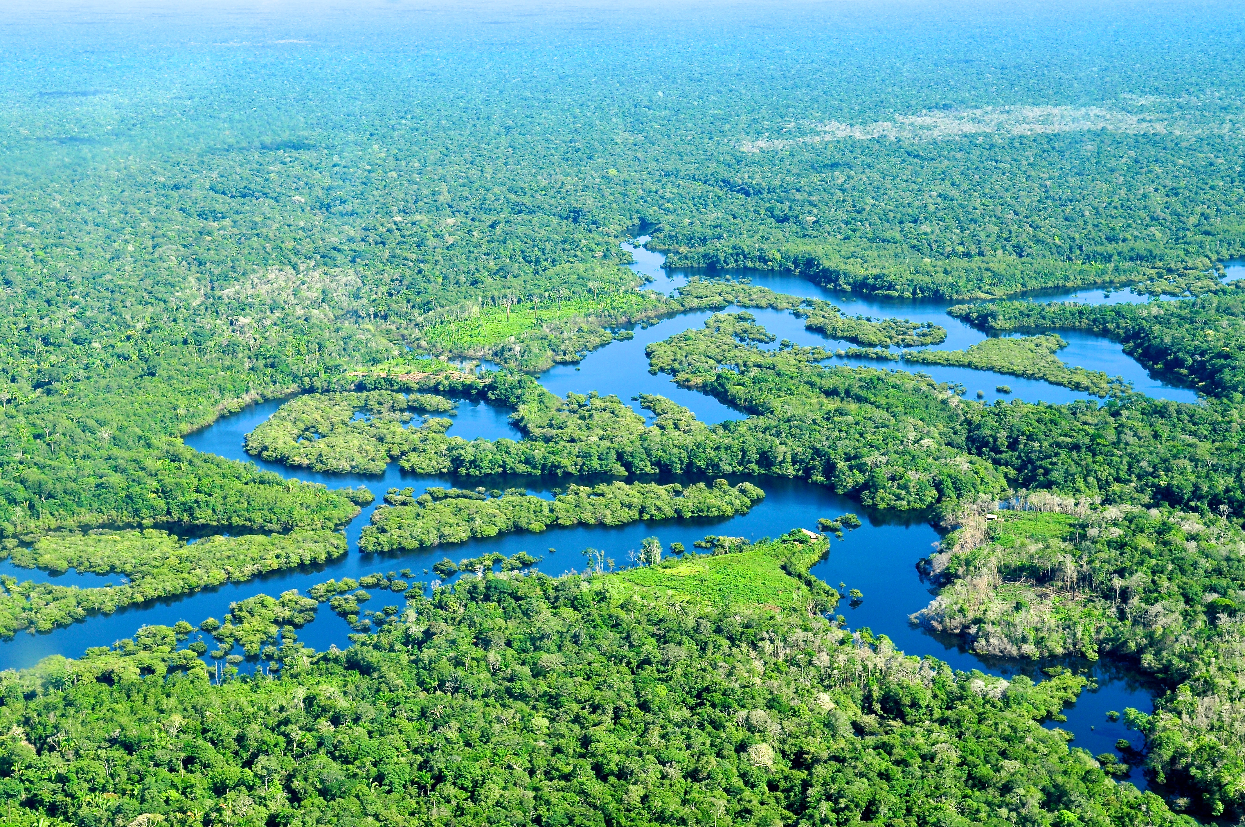
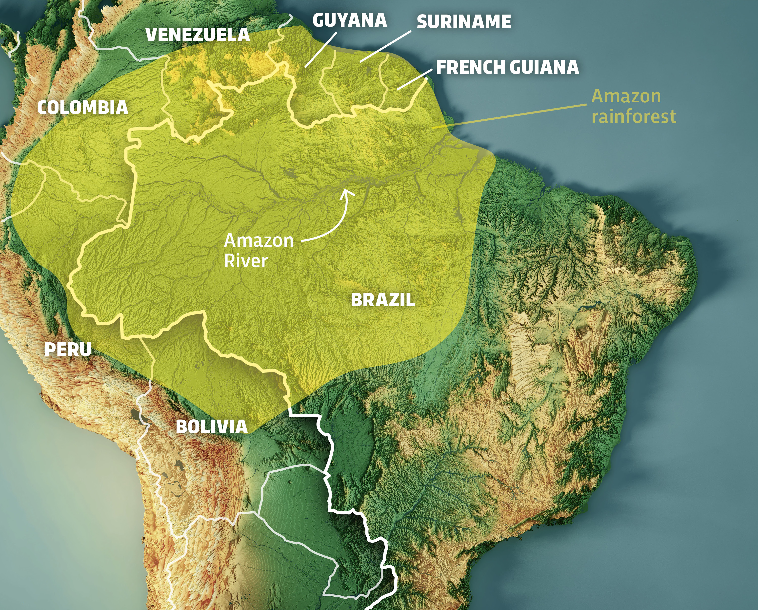
The sheer scale of the Amazon Rainforest—spanning nine South American countries and covering approximately 6.7 million square kilometers—makes comprehensive understanding and monitoring impossible without advanced technological tools. Digital mapping and remote sensing have become indispensable, providing the foundational data layers that underpin almost all modern conservation and research efforts.
Satellite Imagery and Remote Sensing: How Tech Reveals the Amazon’s Scale and Changes
Satellite technology stands as the primary tool for grasping the Amazon’s immensity and tracking its rapid changes. Orbiting earth, satellites equipped with various sensors capture images across the electromagnetic spectrum, providing data far beyond what the human eye can perceive. Optical sensors, such as those on NASA’s Landsat or the European Space Agency’s Sentinel missions, offer high-resolution visible and infrared imagery, allowing scientists to differentiate between forest cover, deforested areas, agricultural land, and water bodies. Synthetic Aperture Radar (SAR) systems, like those on Sentinel-1 or the Japanese ALOS-2, penetrate cloud cover and vegetation, providing critical data on forest structure, biomass, and changes even during the Amazon’s perpetually cloudy wet season.
This constant stream of data forms a digital mosaic of the Amazon, updated daily, weekly, or monthly depending on the satellite constellation. It allows researchers to visualize deforestation fronts, track illegal mining operations, monitor river dynamics, and even identify new species habitats based on unique vegetation signatures. Without this ‘eye in the sky,’ much of the destruction and ecological shifts happening deep within the Amazon would remain hidden, making effective intervention virtually impossible. The digital rendering of the Amazon, through satellite data, is the first step in truly understanding its current state and evolution.
GIS and Geospatial Data: Creating Digital Models for Understanding and Planning
Geographic Information Systems (GIS) provide the crucial framework for organizing, analyzing, and visualizing the vast quantities of geospatial data collected from satellites and ground sensors. A GIS isn’t just a mapping tool; it’s a powerful analytical platform that integrates diverse data layers—such as forest cover, river networks, protected areas, indigenous territories, infrastructure projects (roads, dams), and climate data—to build comprehensive digital models of the Amazon.
These digital models allow researchers, governments, and NGOs to identify patterns, conduct spatial analyses, and simulate potential future scenarios. For instance, by overlaying deforestation data with proposed road construction plans, conservationists can predict future impacts and advocate for preventative measures. GIS enables the creation of highly detailed digital maps that are dynamic and interactive, offering insights into land use change, biodiversity hotspots, and areas under threat. This geospatial understanding is fundamental to strategic planning for conservation, sustainable resource management, and even infrastructure development, ensuring decisions are data-driven and spatially informed.
AI and Big Data: Unlocking the Amazon’s Secrets
The deluge of data generated by satellites, sensors, and ground expeditions would be overwhelming without the transformative power of Artificial Intelligence (AI) and big data analytics. These technologies are crucial for sifting through terabytes of information, identifying subtle patterns, and deriving actionable insights that were previously unattainable.
Biodiversity Tracking and Species Identification: AI’s Role in Cataloging Life
The Amazon is home to an estimated 10% of the world’s known species, with countless more yet to be discovered. AI is revolutionizing the challenging task of biodiversity tracking and species identification. Machine learning algorithms can analyze vast datasets of images, audio recordings, and even environmental DNA (eDNA) to identify and monitor species with unprecedented speed and accuracy. For instance, AI-powered image recognition can process thousands of camera trap photos to identify individual animals, track their movements, and estimate population sizes, bypassing the laborious manual review process.
Similarly, acoustic monitoring devices deployed in the rainforest capture continuous soundscapes, which AI can then analyze to identify distinct animal calls—from birds and amphibians to insects and even human activity. This not only helps in cataloging known species but also in detecting the presence of rare or elusive animals, providing vital data for conservation strategies. By automating these complex analytical tasks, AI allows scientists to scale up their biodiversity research, offering a more complete and dynamic picture of what lives within the Amazon.
Deforestation Detection and Prediction: Using Algorithms to Combat Ecological Threats
Perhaps one of AI’s most impactful applications in the Amazon is its role in combating deforestation. Satellite imagery provides the raw data, but AI algorithms are the engines that turn this data into actionable intelligence. Machine learning models are trained on historical deforestation patterns, current satellite images, and other variables like weather, land tenure, and commodity prices. They can then automatically identify new clearings, track the rate of forest loss, and even predict areas at high risk of future deforestation.
Systems like DETER (Detection of Real-Time Deforestation) developed by Brazil’s National Institute for Space Research (INPE) use AI to provide near real-time alerts to enforcement agencies, allowing for rapid response to illegal logging and agricultural expansion. Predictive models, leveraging AI, can identify ‘hotspots’ where deforestation is likely to occur next, enabling proactive conservation efforts and targeted patrols. This data-driven approach transforms reactive responses into strategic, preventative actions, making the fight against deforestation significantly more efficient and effective.
IoT and Sensor Networks: Real-time Insights from the Forest Floor
While satellites provide a macro view, the Internet of Things (IoT) and networks of interconnected sensors offer a granular, real-time perspective from within the rainforest itself. These ground-based technologies bridge the gap between remote sensing and direct observation, providing critical data from the heart of the Amazon.
Environmental Monitoring: Tracking Climate, Water Quality, and Pollution
IoT sensors are deployed throughout the Amazon to continuously monitor a range of environmental parameters. Small, robust devices can measure air temperature, humidity, rainfall, soil moisture, and river levels, transmitting data wirelessly to central databases. This real-time climate data is invaluable for understanding local weather patterns, predicting floods or droughts, and assessing the impact of climate change on the rainforest ecosystem.
Beyond climate, specialized sensors monitor water quality, detecting pollutants from mining operations or agricultural runoff. Air quality sensors can identify smoke from forest fires, even when the fires themselves are difficult to spot from space due to canopy cover. These localized data points complement broader satellite observations, providing a detailed picture of environmental health and stress, crucial for understanding what the Amazon is experiencing on a daily basis.
Acoustic Monitoring for Wildlife and Illegal Activities: Listening to the Amazon
Acoustic sensors, often integrated into IoT networks, serve as silent sentinels of the Amazon. These devices continuously record the ambient sounds of the rainforest. AI algorithms then analyze these vast audio files to identify specific animal calls, providing a non-invasive way to monitor biodiversity, track species distribution, and even detect the presence of rare nocturnal animals.
Crucially, acoustic monitoring is also a powerful tool for detecting illegal activities. The sounds of chainsaws, vehicles, gunshots, or human voices in remote areas can trigger alerts, signaling potential illegal logging, poaching, or encroachment. These auditory ‘tripwires’ provide early warnings to rangers and authorities, extending the reach of protection efforts into areas that would otherwise be impossible to patrol regularly. By listening to the Amazon through these technological ears, we gain an unparalleled understanding of its hidden life and the threats it faces.
Digital Platforms and Collaboration: Mobilizing Global Action
The challenge of protecting the Amazon is too vast for any single entity. Digital platforms and collaborative tools are essential for sharing knowledge, coordinating efforts, and mobilizing global support, transforming what was once fragmented data into a cohesive, collective endeavor.
Data Sharing and Open Science Initiatives: Democratizing Amazon Knowledge
Many organizations and researchers are committed to open science, utilizing digital platforms to share their data and research findings freely. Websites and online portals host vast repositories of satellite imagery, environmental data, species inventories, and scientific publications, making Amazon-related knowledge accessible to a global audience. Platforms like SERVIR-Amazonia, operated by NASA and USAID, provide geospatial data and tools to address environmental challenges. This democratization of information fosters greater collaboration, enables independent verification of findings, and accelerates the pace of scientific discovery and conservation action. By centralizing and sharing data, these platforms create a shared understanding of what the Amazon is and what it needs.
Virtual Reality and Immersive Experiences: Bringing the Amazon to the World
Technology also allows for immersive experiences that bring the Amazon Rainforest to people who may never have the opportunity to visit it physically. Virtual Reality (VR) and Augmented Reality (AR) applications offer compelling ways to educate and engage the public. VR experiences can transport users deep into the Amazon, allowing them to ‘explore’ its landscapes, encounter its wildlife, and understand its ecological processes. This immersive storytelling builds empathy and awareness, highlighting the rainforest’s beauty and fragility. By making the Amazon accessible through digital means, these technologies help to cultivate a global constituency dedicated to its protection, showcasing its grandeur and urgency to a worldwide audience.
The Future of Amazon Conservation: Tech-Driven Solutions and Challenges
As the Amazon faces escalating threats from climate change, deforestation, and resource exploitation, technology will continue to play an increasingly critical role in its future. However, harnessing these tools effectively also presents its own set of challenges.
Emerging Technologies (e.g., Drones, Gene Editing for Restoration): New Frontiers
The technological landscape is constantly evolving, bringing new innovations to the forefront of Amazon conservation. Drones, for instance, offer flexible and cost-effective aerial surveillance, capable of inspecting remote areas, mapping small-scale deforestation, and even planting seeds for reforestation. Autonomous underwater vehicles (AUVs) are being explored for river monitoring and aquatic biodiversity assessment. In the realm of biotechnology, advancements in gene editing or synthetic biology could potentially be leveraged for ecological restoration, though these applications come with significant ethical and ecological considerations. Nanotechnology might offer solutions for advanced filtration of polluted water. These emerging technologies represent new frontiers in understanding and protecting what the Amazon truly is.
Ethical Considerations and Digital Divide: Ensuring Equitable and Responsible Tech Use
Despite the immense promise of technology, its deployment in the Amazon must navigate complex ethical and social landscapes. The digital divide is a significant concern; indigenous communities, often the frontline guardians of the forest, may lack access to the very technologies that could empower them. Ensuring that technological solutions are developed in consultation with local communities, respect traditional knowledge, and benefit rather than displace them is paramount. Furthermore, issues of data privacy, surveillance, and the potential for misuse of powerful technologies must be carefully addressed. The future of the Amazon, through a technological lens, is not just about the gadgets and algorithms, but about how these tools are wielded responsibly, equitably, and in harmony with both nature and its human inhabitants, ultimately shaping how we define and preserve this irreplaceable global treasure.
aViewFromTheCave is a participant in the Amazon Services LLC Associates Program, an affiliate advertising program designed to provide a means for sites to earn advertising fees by advertising and linking to Amazon.com. Amazon, the Amazon logo, AmazonSupply, and the AmazonSupply logo are trademarks of Amazon.com, Inc. or its affiliates. As an Amazon Associate we earn affiliate commissions from qualifying purchases.