In the modern digital landscape, the question “What district am I in in Florida?” is no longer answered by unfolding a paper map or visiting a local courthouse. As Florida’s population continues to surge, the infrastructure required to manage its complex web of congressional, state legislative, and local municipal boundaries has moved entirely into the realm of high-level technology. Determining your specific jurisdiction is now a seamless process powered by Geographic Information Systems (GIS), sophisticated database management, and user-centric web applications.
For residents, understanding these technological layers is essential not just for civic participation, but for understanding how “GovTech” (Government Technology) shapes the accessibility of public information. From the algorithmic precision of redistricting software to the front-end interfaces of state-run portals, technology is the silent bridge between a physical address and its political representation.
The Evolution of Geographic Information Systems (GIS) in Florida Governance
At the heart of any answer to the question of district location lies Geographic Information Systems, or GIS. This technology goes far beyond simple mapping; it is a framework for gathering, managing, and analyzing data. In Florida, GIS is the foundational tech used to visualize the state’s complex topography and human-made boundaries.
Understanding the Backend: How Spatial Data Works
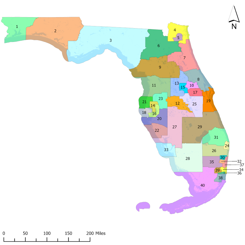
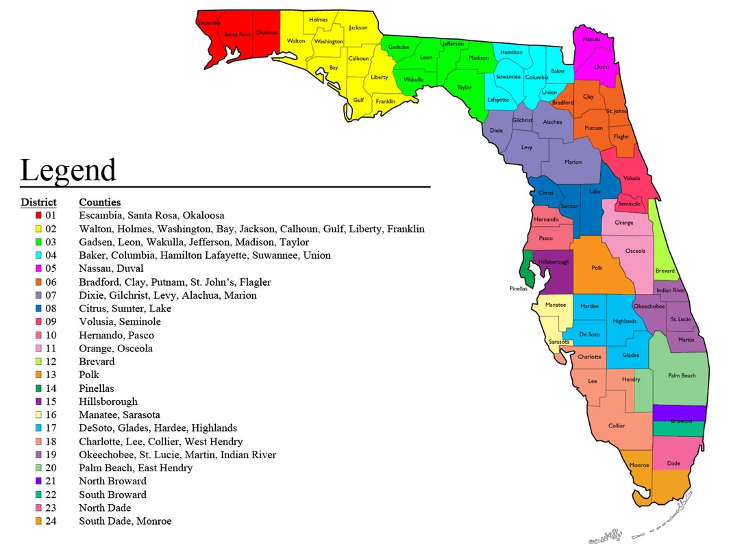
When you enter your address into a search bar to find your district, the software isn’t just looking for a name; it is performing a spatial query against a series of “layers.” In technical terms, Florida’s digital map is composed of shapefiles and geodatabases. One layer might represent the physical terrain, another the street network, and yet another the invisible polygon boundaries of Florida’s 28 Congressional districts or its 120 State House districts.
The technology uses coordinate geometry to determine exactly where a point (your home) intersects with a polygon (the district). This process, known as “point-in-polygon” analysis, happens in milliseconds. The precision of this technology is paramount; in densely populated urban centers like Miami or Orlando, a district line might run down the center of a single street, requiring GPS-level accuracy to ensure a user is placed in the correct jurisdiction.
The Role of the Florida Department of State and Digital Portals
The Florida Department of State, along with the Florida Legislature, maintains the “Source of Truth” for these digital boundaries. Through the use of ESRI’s ArcGIS software—the industry standard in spatial analytics—Florida provides open-data portals that allow other apps and services to pull accurate information.
These portals are designed with high availability in mind. Because district inquiries spike during election cycles, the backend infrastructure must be scalable. Most Florida district-finding tools are hosted on cloud environments like AWS or Azure, ensuring that even when millions of residents query the system simultaneously, the latency remains low and the data remains accessible.
Top Software and Apps for Identifying Your Congressional and State Districts
While the backend data is complex, the front-end technology is designed for simplicity. Various digital tools have been developed to translate raw spatial data into an intuitive user experience.
Official Government Locators vs. Third-Party API Integrations
The most direct way to find your district is through official platforms like MyFloridaHouse.gov or the Florida Senate website. These sites utilize “Find Your Representative” tools that are built on robust API (Application Programming Interface) integrations. When a user types in their ZIP code and street address, the website sends a request to a centralized server, which processes the data and returns the specific legislator and district number.
However, the ecosystem extends beyond government sites. Civic-tech startups and non-profits often use APIs like the Google Civic Information API. This allows third-party developers to build apps that help users find their districts alongside other tech-driven features, such as push notifications for upcoming local votes or digital town hall integrations. This democratization of data ensures that Florida residents aren’t tethered to a single website to find the information they need.
Utilizing Interactive Maps for Real-Time Boundary Data
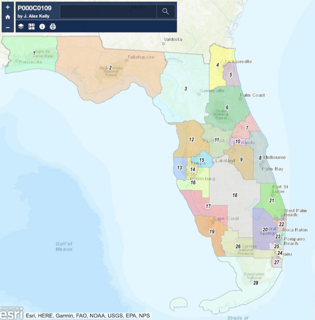
Interactive mapping software has revolutionized how we perceive districts. Instead of a static PDF, modern Florida district tools use “Slippy Maps”—a technology used by Google Maps that allows users to zoom, pan, and click on specific areas.
These maps are rendered using “tiles,” which are small, square images served by a web server. As you zoom into a neighborhood in Tampa or Jacksonville, the browser fetches higher-resolution tiles. This tech allows residents to see exactly where a district line cuts through their community. For those interested in the “why” behind their district, these interactive tools often include “info-windows” that display demographic data, historical voting patterns, and even the digital boundary’s coordinates, all pulled in real-time from the state’s cloud-based GIS servers.
The Intersection of Civic Tech and Data Accuracy
The technology used to find a district is only as good as the technology used to create the district. Every ten years, following the census, Florida undergoes redistricting—a process that is now almost entirely driven by high-powered algorithmic software.
How Redrawing Boundaries is Managed via Algorithmic Software
Redistricting in Florida involves massive datasets including population counts, racial demographics, and geographic shifts. Software such as Maptitude or Citygate’s AutoBound allows mapmakers to draw boundaries that comply with constitutional requirements. These programs use “Optimization Algorithms” to suggest district shapes that maintain equal population distribution (the “one person, one vote” principle).
From a tech perspective, this is a massive computational challenge. The software must account for “contiguity” (ensuring all parts of a district are connected) and “compactness” while processing millions of data points. When a resident asks “What district am I in?”, the answer is the result of thousands of hours of algorithmic processing designed to balance these complex variables.
Data Privacy and Security in Voter Registration Portals
When using digital tools to find your district, security is a major consideration. Many Florida “District Finder” tools are integrated with voter registration databases. This requires a high level of digital security, including SSL (Secure Sockets Layer) encryption to protect the user’s address and personal information.
Furthermore, Florida’s “GovTech” sector must defend against SQL injection attacks and other cyber threats that could attempt to manipulate the displayed boundaries. Ensuring the integrity of the digital map is a matter of cybersecurity. State technicians use “versioning” in their databases, meaning any change to a district boundary must be digitally signed and audited, creating a clear “paper trail” in the digital realm.
Future Trends: AI and Blockchain in Jurisdictional Mapping
As we look toward the future, the technology used to define and find Florida districts is set to become even more advanced. We are moving away from static databases toward dynamic, AI-enhanced systems.
AI-Driven Predictive Modeling for District Population Shifts
Artificial Intelligence is beginning to play a role in how Florida manages its jurisdictions. Machine learning models can analyze real-time migration data—tracking where people are moving within the state—to predict when a district might exceed its population capacity long before the next census. This “Predictive GIS” helps urban planners and tech-forward legislators understand how the digital map of Florida will need to evolve. AI can also be used to detect “gerrymandering” by running millions of simulations to see if a district’s shape is a statistical anomaly or a logical geographic grouping.
Ensuring Transparency Through Immutable Digital Records
There is a growing conversation around using blockchain technology to store jurisdictional boundaries. By placing Florida’s district maps on a distributed ledger, the state could ensure that the boundaries are “immutable”—meaning they cannot be changed without a transparent, recorded transaction. This would provide an unprecedented level of trust for the citizen. When you search for your district, you wouldn’t just be taking the website’s word for it; you could verify the boundary against a blockchain record that proves the map hasn’t been tampered with since its official adoption.
Conclusion
The answer to “What district am I in in Florida?” is a testament to the power of modern technology. What seems like a simple piece of information is actually the output of a sophisticated stack of GIS software, cloud computing, and algorithmic data analysis. As Florida continues to embrace the digital frontier, the tools available to its residents will only become more precise, transparent, and accessible. Whether through an interactive map on a smartphone or a secure query on a government portal, technology ensures that every Floridian can find their place in the state’s complex legislative landscape with just a few clicks.
aViewFromTheCave is a participant in the Amazon Services LLC Associates Program, an affiliate advertising program designed to provide a means for sites to earn advertising fees by advertising and linking to Amazon.com. Amazon, the Amazon logo, AmazonSupply, and the AmazonSupply logo are trademarks of Amazon.com, Inc. or its affiliates. As an Amazon Associate we earn affiliate commissions from qualifying purchases.