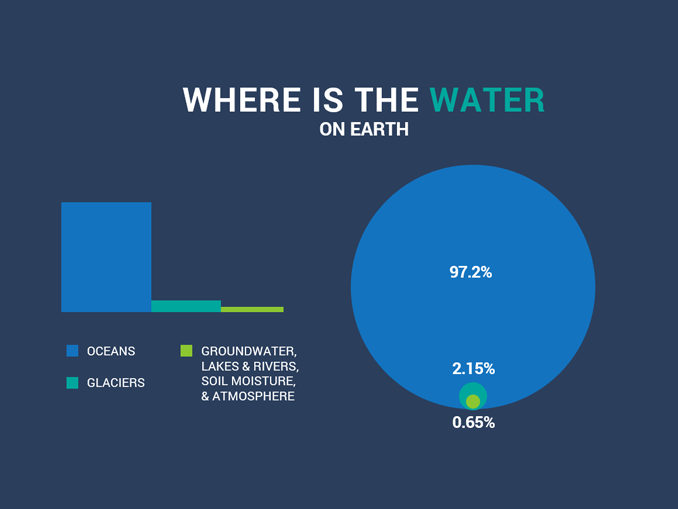
The question “what percent of the Earth’s surface is water?” is fundamental to understanding our planet. The widely accepted figure is approximately 71%. This means that nearly three-quarters of the Earth’s surface is covered by water, with the remaining 29% being landmass. This vast expanse of water, primarily oceans, plays a critical role in regulating climate, supporting biodiversity, and sustaining life. While the number itself seems straightforward, arriving at this precise measurement, understanding its implications, and managing this invaluable resource is a complex endeavor, heavily reliant on a sophisticated array of technological advancements. In an era where climate change and resource scarcity are pressing concerns, technology serves as our indispensable ally in not just quantifying, but also comprehending, managing, and preserving our planet’s most vital component.

This article delves into the technological innovations that enable us to answer this question with remarkable precision, explore beyond surface-level understanding, and develop robust solutions for water resource management. From orbiting satellites to sophisticated AI models, technology provides the eyes, brains, and tools necessary to navigate the complexities of our blue planet.
The Technological Lens: Quantifying Our Blue Planet
Determining that 71% of Earth’s surface is water is not a task accomplished with a simple measuring tape. It requires advanced observation and analytical capabilities that have evolved dramatically over the last few decades. The precision we now have is a testament to the power of remote sensing, geographic information systems, and artificial intelligence.
Satellite Technology and Remote Sensing
At the forefront of quantifying Earth’s water surface are satellites equipped with remote sensing instruments. These orbiting observatories provide a panoramic and consistent view of our planet, allowing scientists to differentiate between land and water with high accuracy.
- Optical Sensors: Satellites like those in the Landsat program (NASA/USGS) and the European Space Agency’s (ESA) Sentinel missions carry optical sensors that capture images in various wavelengths of light. Water bodies reflect and absorb light differently than land, making them distinguishable in these images. Algorithms are then applied to these spectral signatures to classify pixels as either water or land. This allows for the creation of global water masks and the calculation of surface area.
- Synthetic Aperture Radar (SAR): For cloud-covered regions or to penetrate vegetation, Synthetic Aperture Radar (SAR) systems, such as those on ESA’s Sentinel-1, are invaluable. SAR uses microwaves that can pass through clouds and operate day or night. Water surfaces tend to appear very dark in SAR images due to specular reflection (the radar signal bouncing away from the sensor), while land surfaces produce a stronger backscatter. This contrast enables precise mapping of water bodies, especially in areas prone to persistent cloud cover.
- Altimetry: Satellites equipped with radar altimeters (e.g., Jason-3, Sentinel-6 Michael Freilich) measure the precise height of the sea surface and large inland water bodies. While primarily used for sea level rise monitoring and ocean currents, these measurements also contribute to understanding the extent and changes in water bodies over time, providing another layer of verification for surface area calculations.
The continuous stream of data from these satellite constellations allows for dynamic monitoring, tracking changes in lakes, rivers, and coastal lines due to climate change, human activity, or natural events.
Geographic Information Systems (GIS): Mapping and Data Integration
Once raw data is collected by satellites, Geographic Information Systems (GIS) become the central nervous system for processing, analyzing, and visualizing this information. GIS platforms like Esri’s ArcGIS, QGIS, or Google Earth Engine are powerful tools that integrate diverse datasets, allowing for sophisticated spatial analysis.
- Spatial Analysis and Modeling: GIS enables researchers to perform complex spatial analyses, such as calculating the exact surface area of water bodies, identifying hydrological connectivity, or analyzing changes in water extent over time. By overlaying satellite imagery with topographic data, demographic information, and climate models, GIS provides a holistic view of water resources.
- Data Aggregation and Visualization: GIS platforms are crucial for aggregating vast quantities of data from various sources – satellite imagery, ground-based sensors, historical maps, and climate projections. This data is then transformed into intuitive maps, charts, and 3D models, making complex hydrological information accessible to scientists, policymakers, and the public. This visualization is key to communicating the “what percent” figure and its nuances effectively.
- Change Detection: Using time-series analysis within GIS, scientists can monitor how the percentage of water cover on Earth’s surface changes seasonally or over decades. This is vital for understanding phenomena like glacial melt, reservoir fluctuations, and shifts in wetland areas.
Advanced Data Analytics and AI
The sheer volume and velocity of hydrological data generated by satellites and sensors necessitate advanced data analytics and Artificial Intelligence (AI) to extract meaningful insights. AI, particularly machine learning (ML), is revolutionizing how we process and interpret this information.
- Automated Feature Extraction: ML algorithms can be trained on vast datasets to automatically identify and delineate water bodies with unprecedented accuracy and speed, surpassing manual interpretation. Deep learning models, especially convolutional neural networks (CNNs), are highly effective at segmenting satellite images into water and non-water classes, improving the precision of surface area calculations.
- Predictive Modeling: AI models can analyze historical trends and real-time data to predict future changes in water distribution. This includes forecasting drought conditions, predicting flood risks, modeling the impact of sea-level rise on coastal areas, and estimating future water availability. Such predictions are critical for proactive resource management.
- Anomaly Detection: AI excels at identifying subtle anomalies or unexpected changes in water bodies that might escape human observation. This could indicate pollution events, illegal water diversions, or natural changes occurring more rapidly than anticipated, prompting immediate investigation.
Beyond the Surface: Technologies for Understanding Water’s Depth and Volume
While knowing the surface percentage is critical, understanding the total volume and characteristics of water on Earth requires going beneath the surface. Technologies developed for oceanography and limnology provide crucial insights into the three-dimensional nature of our water resources.
Sonar and Bathymetry
To understand the volume of water in oceans, lakes, and rivers, we need to know their depth. This is where sonar technology and bathymetry come into play.
- Multibeam and Single-beam Sonar: Ships equipped with sonar systems emit acoustic waves into the water. By measuring the time it takes for these waves to bounce off the seabed and return, and knowing the speed of sound in water, the depth can be precisely calculated. Multibeam sonars send out multiple beams simultaneously, mapping a swathe of the seafloor with each pass, creating detailed topographical maps (bathymetric charts).
- Applications: These technologies are essential for navigation, identifying underwater hazards, locating marine resources, studying geological formations, and understanding the physical environment of aquatic ecosystems. Accurate bathymetry is fundamental to calculating the total volume of water in basins and for modeling ocean currents and sea-level rise.
Autonomous Underwater Vehicles (AUVs) and Robotics
Exploring the depths where humans cannot easily go, Autonomous Underwater Vehicles (AUVs) and other aquatic robots are invaluable tools for collecting data directly from the water column and the seafloor.
- Data Collection: AUVs can be programmed to navigate specific paths, collecting high-resolution data on temperature, salinity, oxygen levels, pH, currents, turbidity, and even biological samples. These instruments provide localized, in-situ measurements that complement remote sensing data.
- Environmental Monitoring: AUVs are deployed for monitoring ocean health, tracking pollution plumes, assessing coral reef health, and studying deep-sea ecosystems. Their ability to operate autonomously for extended periods makes them cost-effective and efficient for long-term monitoring programs.
- Remote Operation Vehicles (ROVs): For more interactive tasks requiring human control, Remotely Operated Vehicles (ROVs) are used for inspections, sample collection, and even intervention in underwater environments, such as pipeline maintenance or scientific experiments.
Hydrographic Surveying Tools

Integrating multiple technologies, hydrographic surveying provides comprehensive data for mapping coastal areas, rivers, and inland waters, which are crucial interfaces between the land and the vast ocean.
- Lidar (Light Detection and Ranging): Airborne or drone-mounted LiDAR systems use pulsed laser light to measure distances to the Earth’s surface. Bathymetric LiDAR can even penetrate shallow water, providing detailed depth measurements in coastal zones, estuaries, and rivers where traditional sonar might be less efficient.
- Integrated Systems: Modern hydrographic surveys combine GPS for precise positioning, sonar for depth, LiDAR for shallow areas, and various other sensors to create highly accurate and detailed maps. These maps are critical for maritime navigation, coastal zone management, flood plain mapping, and understanding sediment transport.
Digital Solutions for Water Resource Management and Conservation
Understanding the percentage of water and its distribution is merely the first step. The true challenge lies in managing this resource sustainably, especially freshwater, which constitutes only a tiny fraction of the total water on Earth. Digital solutions are pivotal in addressing the growing global water crisis.
Smart Water Grids and IoT Sensors
The concept of “smart” infrastructure extends to water distribution networks, employing the Internet of Things (IoT) to enhance efficiency and reduce waste.
- Real-time Monitoring: IoT sensors installed in pipes, pumps, and reservoirs continuously monitor water flow, pressure, temperature, and quality. This real-time data allows utilities to identify anomalies, predict potential failures, and respond rapidly to issues.
- Leak Detection and Reduction: One of the most significant advantages of smart grids is their ability to detect leaks almost instantly. Traditional leak detection is often reactive and resource-intensive, but IoT sensors can pinpoint the exact location of a leak, dramatically reducing water loss in distribution networks.
- Optimized Distribution: By analyzing consumption patterns and real-time demand, smart grids can optimize water distribution, ensuring adequate supply where and when it’s needed, while minimizing energy consumption for pumping.
- Smart Irrigation: In agriculture, IoT sensors embedded in the soil measure moisture levels, allowing for precision irrigation that delivers water only when and where it’s necessary, conserving significant amounts of water compared to traditional methods.
Predictive Modeling and Simulation Software
Beyond real-time monitoring, advanced software tools are crucial for foresight and planning in water resource management, enabling a shift from reactive to proactive strategies.
- Hydrological Models: Sophisticated software models simulate the movement and storage of water in various components of the hydrological cycle (precipitation, evaporation, runoff, groundwater flow). These models integrate meteorological data, topographical information, and human interventions to forecast water availability, streamflow, and reservoir levels.
- Drought and Flood Forecasting: By running simulations with different climate scenarios and demand patterns, these tools can predict the likelihood and severity of droughts or floods, providing early warnings and allowing authorities to implement mitigation strategies, such as reservoir releases or water restrictions.
- Climate Change Impact Assessment: Simulation software is vital for understanding how climate change might alter regional water cycles, affecting everything from snowpack accumulation to aquifer recharge, informing long-term water management policies.
AI-Powered Water Purification and Desalination
Addressing water scarcity often involves making non-potable water sources drinkable. AI is accelerating the development and efficiency of these critical technologies.
- Process Optimization: AI algorithms can analyze data from water treatment plants to optimize chemical dosing, filtration rates, and energy consumption, leading to more efficient and cost-effective purification processes.
- Membrane Technology: In desalination plants (converting seawater into freshwater), AI is used to design more efficient membranes, predict membrane fouling, and optimize operational parameters, significantly reducing the energy required for reverse osmosis.
- Automated Quality Control: AI-driven sensors can continuously monitor water quality parameters, detecting contaminants and adjusting treatment processes in real-time, ensuring the delivery of safe drinking water and compliance with health standards.
The Future of Hydrological Tech: Innovation for a Water-Secure World
As global populations grow and climate patterns become more erratic, the importance of water management will only intensify. The future of hydrological technology promises even more integrated, intelligent, and accessible solutions.
Blockchain for Water Rights and Trading
Emerging technologies like blockchain hold potential for transforming how water rights are managed and traded, introducing unprecedented transparency and security.
- Transparent Water Allocation: A blockchain ledger could securely record water rights, ownership, and transactions, providing an immutable and verifiable history. This could significantly reduce disputes, improve accountability, and enable more efficient allocation of this scarce resource, particularly in regions with complex water-sharing agreements.
- Water Market Efficiency: Smart contracts on a blockchain could automate water trading based on predefined conditions, creating more dynamic and efficient water markets that respond to real-time supply and demand, potentially reducing administrative overheads and transaction costs.
- Data Integrity and Governance: Blockchain could also secure and verify environmental data related to water quality and usage, enhancing trust in reporting and supporting better governance of water resources.
AI in Climate Change Mitigation and Adaptation
AI’s role in safeguarding our water future extends beyond mere prediction; it’s becoming instrumental in developing proactive mitigation and adaptation strategies.
- Smart Infrastructure Design: AI can assist in designing resilient water infrastructure that can withstand extreme weather events, such as enhanced flood defenses, drought-resistant irrigation systems, and climate-adaptive urban drainage.
- Nature-Based Solutions Optimization: AI can help identify optimal locations and designs for nature-based solutions, such as wetlands restoration for natural filtration or reforestation for watershed protection, maximizing their ecological and hydrological benefits.
- Policy Support and Scenario Planning: AI-driven models can evaluate the potential impacts of various climate policies on water resources, providing policymakers with data-driven insights to make informed decisions for climate change adaptation and mitigation.
Open-Source Platforms and Citizen Science
The democratization of data and technology is empowering broader participation in water monitoring and conservation efforts.
- Collaborative Data Collection: Open-source platforms and user-friendly mobile apps enable citizen scientists to collect and share data on local water bodies, from water quality measurements to observations of aquatic life. This distributed network of data collection significantly augments official monitoring efforts.
- Community-Led Solutions: Providing communities with accessible tools and data allows them to identify local water issues, participate in monitoring programs, and advocate for specific interventions, fostering a sense of ownership and promoting sustainable practices.
- Data Sharing and Innovation: Open-source GIS tools, data platforms, and AI models facilitate collaboration among researchers, non-profits, and governments, accelerating innovation and the development of localized water solutions.
In conclusion, while the answer to “what percent of the Earth’s surface is water?” remains constant at approximately 71%, the depth of our understanding and the sophistication of our response to this reality are continuously evolving thanks to technology. From the vast scale of global satellite monitoring to the micro-level precision of AI-powered water purification, technological innovation is not just illuminating the facts about our water planet, but actively shaping a more secure and sustainable water future for all.
aViewFromTheCave is a participant in the Amazon Services LLC Associates Program, an affiliate advertising program designed to provide a means for sites to earn advertising fees by advertising and linking to Amazon.com. Amazon, the Amazon logo, AmazonSupply, and the AmazonSupply logo are trademarks of Amazon.com, Inc. or its affiliates. As an Amazon Associate we earn affiliate commissions from qualifying purchases.