
In today’s interconnected world, understanding the “where” is as crucial as understanding the “what” or the “how.” From navigating our daily commutes to managing global supply chains and responding to natural disasters, location intelligence underpins a vast array of human endeavors. At the forefront of this vital field stands Esri, a company that has quietly but profoundly shaped how we visualize, analyze, and interact with geographic information. While the name “Esri” might not be as universally recognized as some tech giants, its technology is deeply embedded in the fabric of countless industries and governmental functions, making it a cornerstone of modern decision-making.
This exploration delves into the essence of Esri, not just as a software provider, but as a driving force behind geographic information systems (GIS) and its pervasive influence across technology, branding, and even the financial landscape. We will uncover what Esri is, the core principles that define its offerings, and how its innovative solutions empower organizations to harness the power of location.
The Core of Esri: Geographic Information Systems (GIS) Explained
At its heart, Esri is synonymous with Geographic Information Systems (GIS). But what exactly is GIS? Imagine a powerful system that combines mapping, data analysis, and visualization in a way that allows users to understand relationships, patterns, and trends related to geographic locations. GIS is not just about creating pretty maps; it’s about turning raw geographic data into actionable insights.
Esri’s journey began in 1969, founded by Jack and Laura Dangermond, with a vision to use geographic principles and technology to solve real-world problems. Over the decades, Esri has evolved into the world’s leading provider of GIS software and services, offering a comprehensive suite of tools that enable users to create, manage, analyze, and share location-based information.
How Esri’s Technology Powers Location Intelligence
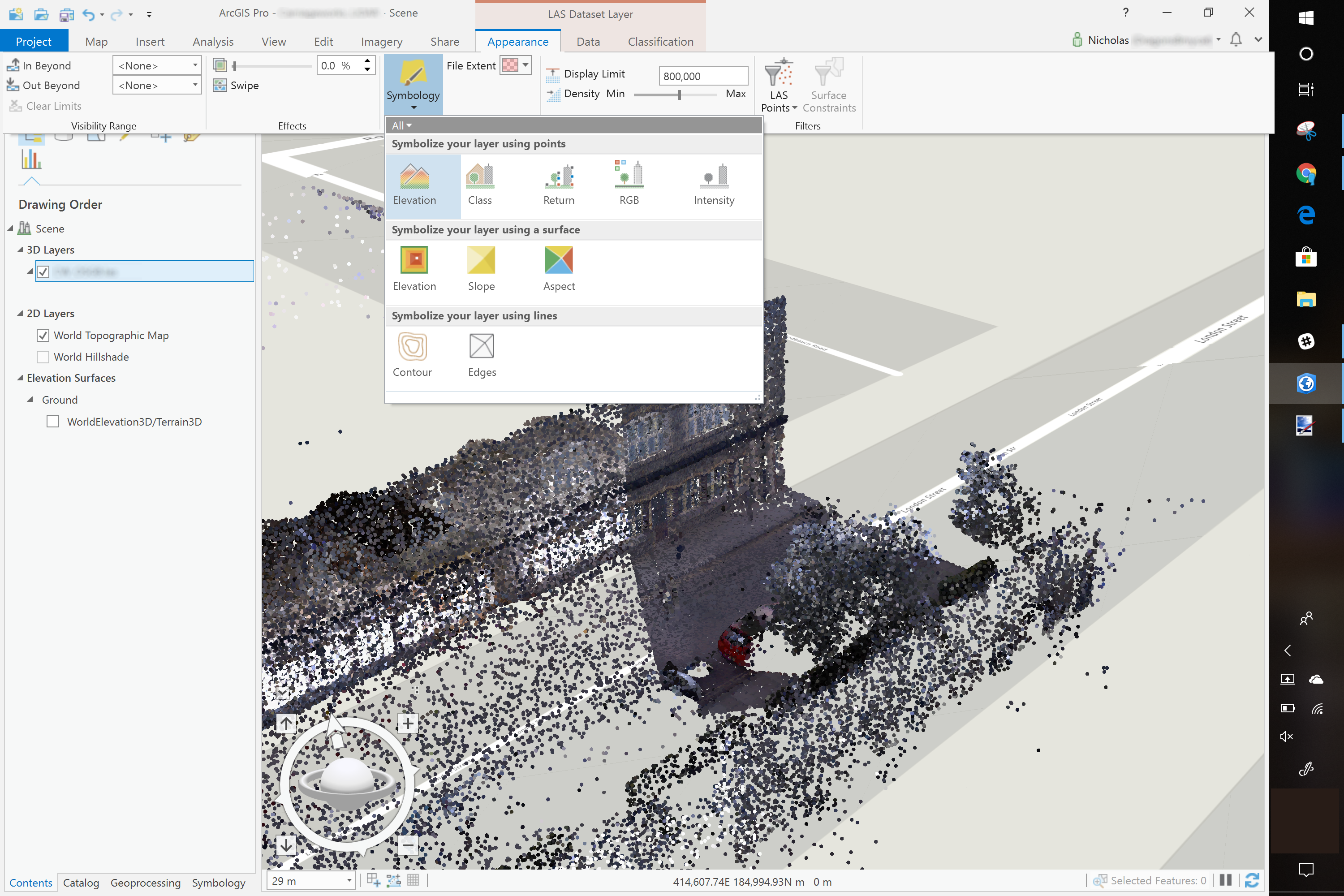
Esri’s flagship product, ArcGIS, is the industry standard for GIS. It’s a powerful and versatile platform that caters to a wide range of users, from individual researchers to large multinational corporations and government agencies. ArcGIS empowers users to:
- Capture and Manage Data: This involves gathering spatial data from various sources, including satellite imagery, GPS devices, surveys, and existing databases. Esri’s tools facilitate the organization and maintenance of this data in a structured and accessible manner.
- Analyze Spatial Relationships: This is where the true power of GIS shines. Users can perform complex analyses to understand how different geographic elements interact. For instance, a city planner might use GIS to identify areas vulnerable to flooding based on elevation data and proximity to rivers. A retail company could analyze customer demographics and store locations to determine optimal sites for new branches.
- Visualize and Map Information: The ability to create compelling and informative maps is a hallmark of GIS. Esri’s software allows for the creation of dynamic maps that can be shared and interacted with. These maps go beyond static representations, offering layers of data that can be toggled on and off, providing different perspectives on the same geographic area.
- Share and Collaborate: In today’s collaborative environment, sharing geographic insights is crucial. Esri’s platform facilitates the dissemination of maps, data, and analyses through web applications, mobile apps, and cloud services, enabling teams to work together seamlessly regardless of their physical location.
The underlying technology of Esri is built on a foundation of robust data management, sophisticated analytical engines, and intuitive user interfaces. This allows for the handling of massive datasets and the execution of complex spatial operations, making it possible to tackle challenges that were previously unimaginable.
Esri’s Broad Reach: Impacting Tech, Brand, and Money
While Esri is fundamentally a technology company, its influence extends far beyond the realm of software development. Its solutions have a profound impact on how brands are built and perceived, how businesses operate financially, and how individuals and organizations navigate the ever-evolving tech landscape.
Navigating the Tech Frontier: Esri’s Role in Innovation
Esri is not just a participant in the technology trends; it actively drives them within the geospatial domain. Their commitment to innovation is evident in their continuous development of new tools and functionalities that leverage emerging technologies:
- Artificial Intelligence (AI) and Machine Learning (ML): Esri is integrating AI and ML into its platform to automate complex tasks, extract insights from imagery, and predict future trends. For example, AI can be used to automatically identify and classify features in satellite imagery, such as buildings, roads, or vegetation, saving significant human effort. ML algorithms can analyze historical data to predict patterns of disease outbreaks or identify areas at high risk of deforestation.
- Cloud Computing: Esri’s robust cloud strategy allows users to access powerful GIS capabilities without the need for extensive on-premises infrastructure. This democratizes access to sophisticated tools, enabling smaller organizations and individuals to leverage the power of GIS.
- Internet of Things (IoT): The proliferation of IoT devices generates a constant stream of location-aware data. Esri’s platform is designed to ingest and analyze this real-time data, providing insights into everything from traffic flow in smart cities to the performance of remote assets in industrial settings.
- Web and Mobile Applications: Esri is a pioneer in making GIS accessible through web browsers and mobile devices. This allows for easy data collection in the field, real-time monitoring, and the creation of interactive maps for public consumption. Think of apps that show you real-time public transport information or help you find the nearest emergency services – these often rely on Esri’s underlying technology.
Beyond its core software, Esri also offers a rich ecosystem of complementary technologies and services. This includes a vast library of publicly available geographic datasets, developer tools for building custom applications, and a thriving community of users and partners who contribute to the advancement of the field.
Crafting Corporate and Personal Brands with Location Intelligence
The concept of “brand” is increasingly intertwined with location. Esri’s technology plays a significant role in how businesses and even individuals build and manage their brand identity and reputation, especially in relation to their physical presence and target markets.
- Understanding Customer Footprints: For businesses, understanding where their customers are and how they interact with their brand geographically is paramount. Esri’s tools allow companies to map customer demographics, analyze purchasing patterns by location, and identify areas with high potential for growth. This informed understanding can shape marketing strategies, product development, and customer service efforts, all contributing to a stronger brand perception.
- Optimizing Retail and Service Delivery: The placement of physical stores, service centers, and distribution hubs is a critical branding decision. Esri’s site selection tools help businesses identify optimal locations that maximize accessibility, minimize competition, and align with their target audience. A well-placed establishment can significantly enhance brand visibility and customer convenience.
- Enhancing Brand Reputation through Corporate Social Responsibility: Many organizations are demonstrating their commitment to sustainability and community engagement through location-based initiatives. Esri’s GIS can be used to map environmental impact, plan conservation efforts, or identify areas in need of social support. Communicating these actions through compelling maps and data visualizations can significantly bolster a brand’s reputation and build trust with stakeholders.
- Personal Branding and Digital Presence: While less direct, even individuals can leverage location data to enhance their personal brands. For professionals who travel extensively or have a global client base, understanding their geographic reach and impact can be a subtle but effective part of their professional narrative. Furthermore, social media platforms often use location data to personalize content and connect users, indirectly influenced by the underlying principles of geographic intelligence.
- Designing with Purpose: Esri’s visual capabilities also contribute to brand design. The creation of clear, informative, and aesthetically pleasing maps is an extension of a brand’s visual language. Consistent branding across all touchpoints, including how geographic information is presented, reinforces a company’s identity and professionalism.
The Financial Implications: Esri’s Role in Business Finance and Investment
The ability to analyze and understand geographic data has direct and significant implications for financial decision-making, business finance, and even investment strategies.
- Optimizing Business Operations and Reducing Costs: By understanding the geography of their operations, businesses can identify inefficiencies and reduce costs. For example, logistics companies use Esri’s GIS to optimize delivery routes, minimizing fuel consumption and delivery times. Retailers can analyze inventory distribution by region to ensure products are available where demand is highest, reducing waste and lost sales. These operational efficiencies directly impact a company’s bottom line and financial health.
- Informed Investment and Market Analysis: Investors and financial institutions utilize GIS for a variety of purposes. Real estate investors can analyze property values, market trends, and demographic shifts by location to identify lucrative investment opportunities. Financial analysts can use GIS to understand the geographic distribution of risk for insurance companies or to map the economic health of different regions to inform investment portfolios.
- Resource Management and Economic Development: Governments and organizations focused on economic development use GIS to identify areas with the greatest potential for growth, attract investment, and plan for infrastructure development. Understanding the geographic distribution of resources, labor availability, and transportation networks is crucial for making sound financial decisions that foster sustainable economic prosperity.
- Risk Assessment and Mitigation: The financial implications of natural disasters, climate change, and other geographic risks are substantial. Esri’s GIS tools help organizations assess these risks, develop mitigation strategies, and plan for disaster response. This proactive approach can save significant financial resources and protect assets. For example, an insurance company can use GIS to map areas prone to wildfires and adjust premiums accordingly, mitigating potential financial losses.
- Online Income and Side Hustles: While not always directly involving Esri’s enterprise-level software, the principles of location intelligence are increasingly relevant for online income streams and side hustles. Freelance data analysts might specialize in geographic data analysis, offering their services to businesses. Individuals building online businesses can use demographic data and market analysis, informed by geographic principles, to identify niche markets and target their marketing efforts effectively.

Esri: A Foundation for Understanding Our World
In conclusion, Esri is far more than just a software company; it is a foundational pillar in our ability to understand and interact with the world around us. Its pioneering work in Geographic Information Systems has revolutionized how we gather, analyze, and visualize location-based data. From the seamless navigation on our smartphones to the complex planning of urban infrastructure and the strategic decisions of global corporations, Esri’s technology is an invisible yet indispensable force.
By empowering organizations and individuals with sophisticated location intelligence, Esri facilitates innovation in technology, shapes the way brands are perceived and built, and provides critical insights for sound financial and investment decisions. As our world becomes increasingly data-driven and interconnected, the importance of understanding the “where” will only continue to grow, solidifying Esri’s position as a leader in shaping our future.
aViewFromTheCave is a participant in the Amazon Services LLC Associates Program, an affiliate advertising program designed to provide a means for sites to earn advertising fees by advertising and linking to Amazon.com. Amazon, the Amazon logo, AmazonSupply, and the AmazonSupply logo are trademarks of Amazon.com, Inc. or its affiliates. As an Amazon Associate we earn affiliate commissions from qualifying purchases.