
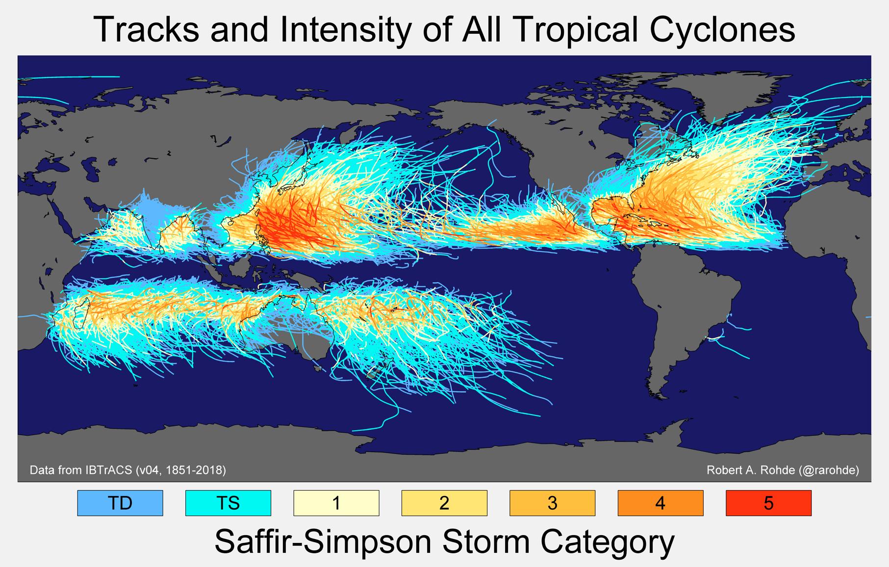
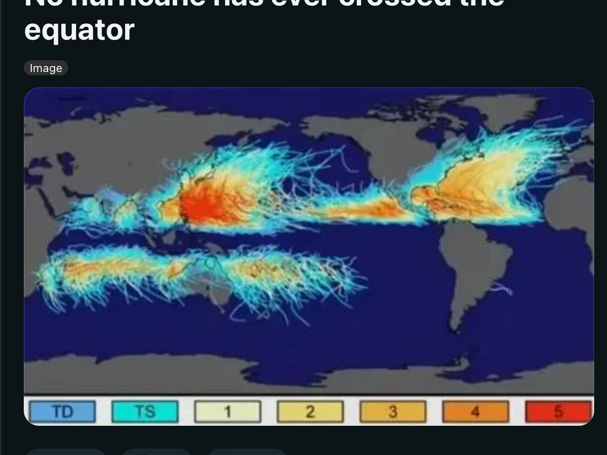
In the lexicon of meteorology and atmospheric science, there is a definitive boundary that serves as an invisible wall for the world’s most powerful tropical cyclones. This line is the Equator. To the uninitiated, it may seem like a mere geographical coincidence, but to the world of climate technology, satellite engineering, and predictive modeling, the Equator represents a fascinating case study in the intersection of physics and digital precision. While typhoons—known as hurricanes in the Atlantic and cyclones in the Indian Ocean—are capable of devastating landmasses and traversing thousands of miles of open ocean, they are physically incapable of crossing the zero-degree latitude mark.

Understanding why this “line” is impassable requires a deep dive into the technology we use to monitor our planet. From the High-Performance Computing (HPC) clusters that simulate atmospheric fluid dynamics to the sophisticated AI algorithms that predict storm tracks, the “Equator problem” is central to how we build resilient digital infrastructure and early warning systems.
The Physics of the Barrier: The Coriolis Force in Computational Models
The primary reason a typhoon cannot cross the Equator is the Coriolis effect. In simple terms, the Coriolis effect is the deflection of moving objects (like air masses) caused by the Earth’s rotation. In the Northern Hemisphere, this force deflects moving air to the right, creating the counter-clockwise rotation characteristic of a typhoon. In the Southern Hemisphere, the deflection is to the left, causing clockwise rotation. At the Equator, the Coriolis force is zero. Without this rotational “kick,” a storm cannot maintain the organized vortex structure required to be classified as a typhoon.
The Role of Numerical Weather Prediction (NWP)
Modern technology visualizes this physical constraint through Numerical Weather Prediction (NWP) software. These are complex mathematical models that simulate the atmosphere using grids of data points. Developers and atmospheric scientists use massive datasets—petabytes of information regarding temperature, pressure, and wind speed—to feed these models. When a simulation attempts to push a tropical cyclone toward the Equator, the software’s algorithms reflect the physical reality: the storm loses its “spin” as it approaches 5 degrees latitude.
If a storm were to cross the Equator, its rotation would effectively have to stop and then restart in the opposite direction—a physical impossibility under current atmospheric conditions. Tech stacks used by organizations like the National Oceanic and Atmospheric Administration (NOAA) utilize these “boundary conditions” to ensure that their predictive models remain accurate. If a model were to show a typhoon crossing the line, it would be a clear indicator of a “bug” in the simulation’s physics engine.
Simulating the “No-Go Zone” with High-Performance Computing
Processing the sheer volume of variables required to map these boundaries necessitates extreme computing power. Modern storm modeling leverages “supercomputer” clusters that perform quadrillions of calculations per second. These simulations are not just academic; they are the backbone of digital security for coastal cities. By understanding the “Equator line” as a hard-coded limit in the Earth’s operating system, tech developers can allocate cloud computing resources more effectively, focusing high-resolution tracking on the “storm corridors” where typhoons are actually viable.
Predictive Analytics and the Evolution of Early Warning Systems
While the Equator acts as a natural barrier, the tech industry is preoccupied with what happens everywhere else. The real challenge lies in predicting where a typhoon will go before it hits a populated coastline. This is where AI-driven predictive analytics have revolutionized the field.
AI-Driven Storm Path Forecasting
Traditional forecasting relied heavily on human interpretation of radar data. Today, machine learning (ML) models are taking the lead. Companies like Google and IBM (via The Weather Company) have developed AI models that can outperform traditional physics-based models in both speed and accuracy. These AI tools use “deep learning” to analyze decades of historical storm data, identifying patterns that are invisible to the human eye.
One of the most significant breakthroughs in this niche is the transition from “deterministic” to “probabilistic” forecasting. Instead of predicting a single line of travel, AI generates thousands of “ensemble” simulations simultaneously. If 95% of those simulations show a typhoon veering away from a specific region, emergency management apps can provide hyper-localized alerts to residents with a high degree of confidence.
Neural Networks and Real-Time Data Integration
The integration of neural networks into weather tech allows for real-time adjustments. As a typhoon moves, IoT sensors on ocean buoys and automated weather stations feed data directly into the cloud. The AI recalibrates the storm’s trajectory every few seconds. This is a far cry from the daily or six-hourly updates of the past. For tech-driven logistics companies and global shipping fleets, this real-time data is the difference between a safe reroute and a multi-million-dollar loss.
Satellites and Remote Sensing: Monitoring the Cross-Equatorial Boundary
The “line” a typhoon cannot cross is monitored 24/7 by a sophisticated fleet of satellites. These are not merely cameras in space; they are advanced remote-sensing platforms that act as the Earth’s digital nervous system.
Geostationary vs. Polar-Orbiting Assets
To monitor typhoons, technology utilizes two main types of satellites. Geostationary satellites, such as the GOES-R series or Japan’s Himawari-8, remain fixed over a single spot on the Equator. They provide high-frequency imagery every few minutes, allowing tech platforms to create the high-definition “time-lapse” loops seen on news broadcasts and weather apps.
On the other hand, Polar-orbiting satellites circle the Earth from pole to pole, crossing the Equator at high speeds. These satellites carry specialized instruments like microwave sounders that can “see” through thick clouds to measure the internal structure of a typhoon. The data throughput from these satellites is immense, requiring robust ground station infrastructure and advanced data compression algorithms to transmit high-fidelity information to researchers on Earth.
Hyperspectral Imaging and Data Streams
The latest generation of satellites utilizes hyperspectral imaging, which captures data across hundreds of narrow bands of the electromagnetic spectrum. This technology allows scientists to measure moisture levels at specific altitudes with surgical precision. For the software developers building disaster-response tools, this “vertical” data is critical. It allows them to map not just where the storm is, but how intense its rainfall will be—a key metric for flood-prediction software used in smart-city planning.
IoT and the Ground-Level Digital Shield
While satellites look down from above, the “Internet of Things” (IoT) provides a ground-level view of how typhoons interact with our environment. The technology deployed at the surface is what ultimately protects human life and digital infrastructure.
Smart Infrastructure and Sensor Networks
In typhoon-prone regions like Southeast Asia and the Pacific, “smart” infrastructure is becoming the standard. This includes bridges equipped with strain gauges, power grids with automated circuit breakers, and seawalls with pressure sensors. All of these devices are connected to central monitoring hubs via 5G or satellite links.
When a typhoon approaches, these IoT networks act as an automated defense system. For instance, if sensors detect a certain wind threshold, smart-grid software can preemptively reroute power to critical facilities like hospitals while shutting down high-risk lines to prevent fires. This “digital shield” is a direct application of edge computing, where data is processed locally at the sensor level to ensure near-instantaneous response times.
Edge Computing in Disaster Mitigation
The latency involved in sending data to a distant cloud server can be dangerous during a storm. Edge computing solves this by placing processing power closer to the source. During a typhoon, local “fog” nodes can analyze wind patterns and trigger automated alerts to mobile devices in the immediate vicinity, even if the primary internet backbone is compromised. This resilience is a core focus of modern digital security and disaster-tech architecture.
The Future of Climate Tech: Can Software Prevent Storm Intensification?
As we look toward the future, the conversation is shifting from “how do we track typhoons” to “how can we use technology to mitigate them?” While we cannot change the fact that a typhoon won’t cross the Equator, we are developing tools to understand—and perhaps eventually influence—how they gain energy over the open ocean.
Digital Twins of the Earth’s Climate
One of the most ambitious projects in the tech world today is the creation of a “Digital Twin” of the Earth. Utilizing the most powerful AI and supercomputing resources available, organizations like the European Space Agency are building a highly accurate digital replica of our planet’s climate systems. This allows researchers to run “what-if” scenarios: What if ocean temperatures were 1 degree lower? What if we deployed a massive fleet of autonomous “cloud-seeding” drones?
While we are far from controlling the weather, these digital twins allow for unprecedented levels of preparation. For brand-new smart cities being built today, engineers use these simulations to determine the exact placement of buildings and drainage systems to minimize wind and water damage.
The Role of Blockchain in Disaster Recovery
Even with the best predictive tech, damage occurs. The “FinTech” side of disaster management is now incorporating blockchain to streamline insurance claims. Through “parametric insurance,” a smart contract can be triggered automatically when a typhoon’s wind speed, as verified by independent satellite data, crosses a certain threshold. There is no need for a manual inspection; the technology verifies the event and releases funds to affected areas instantly. This intersection of satellite data and decentralized finance (DeFi) is a testament to how deep the tech stack goes in modern storm management.
The “line” a typhoon can never cross is a reminder of the physical laws that govern our planet. However, the technology we build around that line—from the satellites in geostationary orbit to the AI models running in data centers—is what defines our ability to survive and thrive in an era of increasingly extreme weather. As we continue to refine our digital tools, the “Equator problem” remains a constant, a physical certainty in an otherwise unpredictable world of data and atmospheric chaos.
aViewFromTheCave is a participant in the Amazon Services LLC Associates Program, an affiliate advertising program designed to provide a means for sites to earn advertising fees by advertising and linking to Amazon.com. Amazon, the Amazon logo, AmazonSupply, and the AmazonSupply logo are trademarks of Amazon.com, Inc. or its affiliates. As an Amazon Associate we earn affiliate commissions from qualifying purchases.