
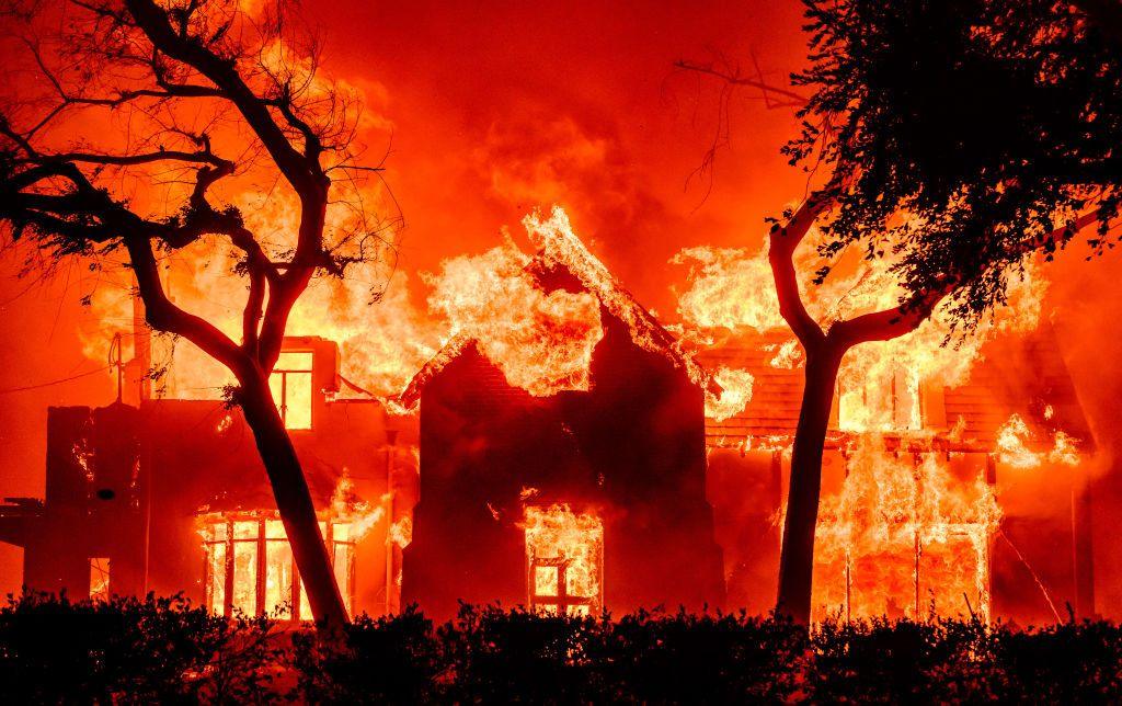
California’s relationship with fire has shifted from a seasonal concern to a perennial crisis. As the state grapples with more intense heatwaves, prolonged droughts, and an accumulation of dry fuel, the traditional methods of firefighting—while still vital—are being bolstered by a sophisticated array of emerging technologies. To understand what is happening with the fires in California today, one must look beyond the headlines of destruction and into the command centers where artificial intelligence, satellite constellations, and autonomous systems are reshaping the frontline of disaster management.
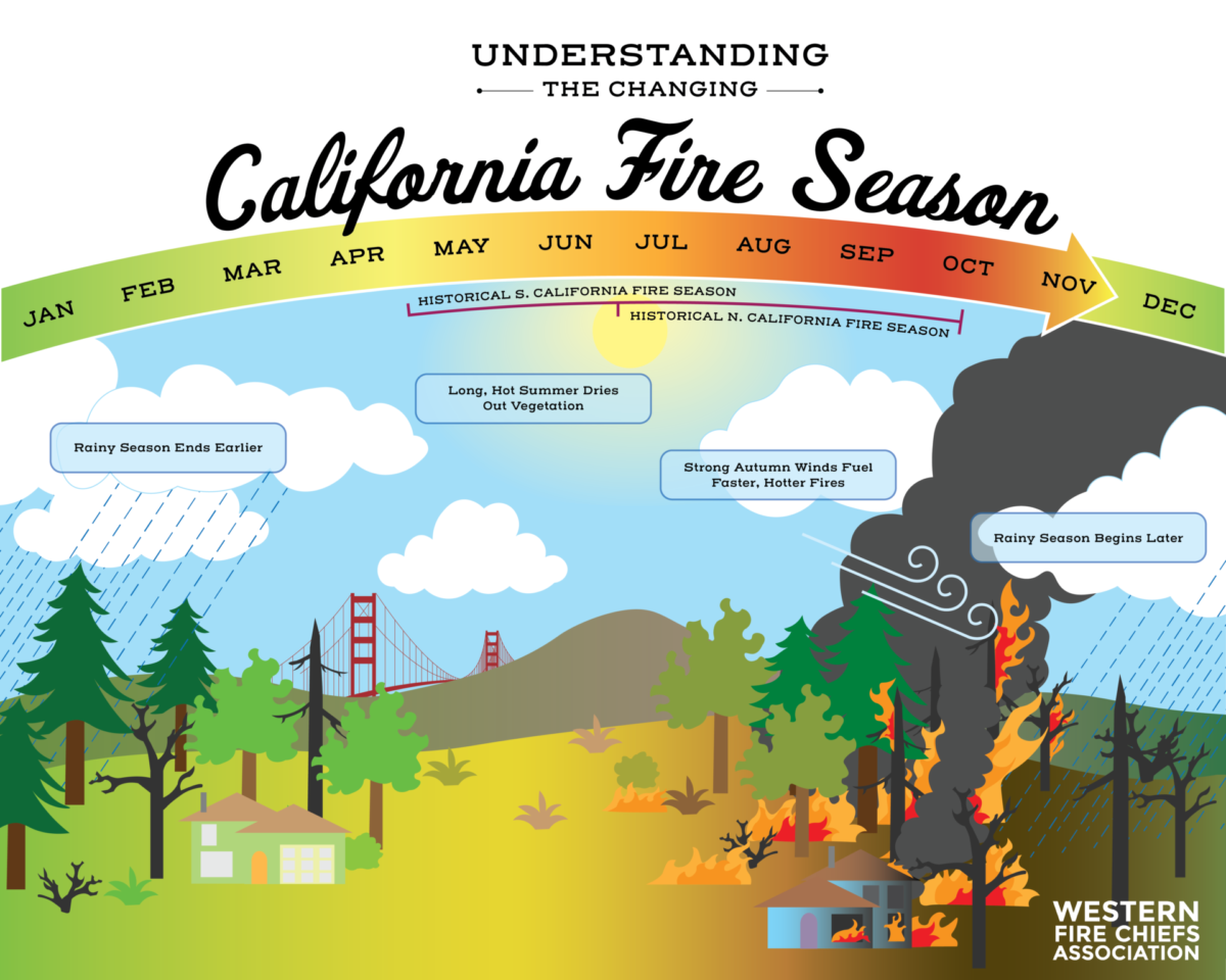
The “new normal” of the California wildfire landscape has necessitated a fundamental pivot from reactive suppression to proactive, tech-driven mitigation. This transition is defined by the integration of massive datasets, real-time sensing, and hyper-accurate predictive modeling. By leveraging these tools, state agencies and private tech firms are aiming to catch ignitions within minutes and predict fire behavior with unprecedented precision.
Predictive Modeling and AI: Anticipating the Unpredictable
The most significant shift in California’s fire strategy is the deployment of Artificial Intelligence (AI) to identify fires before they grow out of control. Traditionally, smoke detection relied on human observers in lookout towers or reports from citizens. Today, a digital net is cast across the state’s most vulnerable landscapes.
Machine Learning in Early Detection
The ALERTCalifornia program, a collaboration between UC San Diego and Cal Fire, represents the pinnacle of AI-integrated surveillance. This network utilizes over 1,000 high-definition, pan-tilt-zoom cameras strategically placed across the state. These cameras do more than just record video; they feed data into AI algorithms trained to distinguish between clouds, dust, and smoke.
When the AI detects a potential smoke plume, it alerts emergency dispatchers immediately, often before a 911 call is even placed. This “seconds count” mentality is crucial in the initial attack phase. If a fire can be contained within the first few acres, the risk of a catastrophic event drops exponentially. The machine learning models are constantly evolving, learning from false positives—like agricultural dust or steam—to become more accurate with every passing season.
Digital Twins and Forest Management
Beyond detection, AI is being used to create “Digital Twins” of California’s forests. By combining LiDAR (Light Detection and Ranging) data with satellite imagery, researchers can build high-resolution 3D models of specific geographical areas. These digital replicas allow fire scientists to run simulations on how a fire might move through a particular canyon or ridge based on current fuel moisture, wind speed, and slope.
These simulations are not just academic; they are operational tools. Incident commanders can use these models to determine the most effective locations for fire lines or to predict which neighborhoods require evacuation orders hours before the flames arrive. This predictive power transforms wildfire management from a game of catch-up into a strategic, data-driven operation.
Space-Based Surveillance: Satellite Monitoring and Real-Time Detection
While ground-based cameras provide a granular view, the view from space offers the scale necessary to manage a state as large as California. Satellite technology has evolved from providing once-a-day snapshots to delivering near-continuous monitoring of thermal anomalies.
Low Earth Orbit (LEO) Satellites and Heat Mapping
A new generation of Low Earth Orbit (LEO) satellites is changing the game for fire detection. Companies and government agencies are launching “FireTech” constellations equipped with infrared sensors capable of detecting heat signatures as small as a backyard bonfire from hundreds of miles above.
Unlike older meteorological satellites that had coarse resolutions, these new systems provide high-frequency updates. When a new ignition occurs in a remote area of the Sierra Nevada, these satellites can pinpoint the coordinates and transmit the data to ground stations in minutes. This is particularly vital for lightning-strike fires in wilderness areas that might otherwise go undetected for hours, allowing Cal Fire to deploy aerial tankers before the fire gains momentum.
Remote Sensing for Post-Fire Impact Analysis
The utility of satellite tech extends beyond active fire suppression. Synthetic Aperture Radar (SAR) and multispectral imaging are used after the smoke clears to assess “burn severity.” This data is essential for identifying areas at risk of mudslides and flash floods—secondary disasters that often follow California fires. By analyzing the change in vegetation and soil structure from space, engineers can prioritize stabilization efforts and infrastructure repairs, ensuring that the technological response addresses the entire lifecycle of a fire event.

Aerial Innovation: Drones and Autonomous Firefighting Systems
The skies over California fires are becoming increasingly crowded with Unmanned Aircraft Systems (UAS), commonly known as drones. These tools are filling critical gaps where manned aircraft face limitations, particularly in visibility and safety.
UAS for Reconnaissance and Night Operations
One of the most dangerous times for firefighting is at night, when heavy smoke and darkness often ground traditional helicopters and tankers. Drones, however, do not share these limitations. Equipped with thermal imaging cameras, drones can fly through thick smoke and darkness to map the “fire edge” in real-time.
This “eyes in the sky” capability allows ground crews to see where the fire is most active, even when they are blinded by smoke. Furthermore, drones are being used for “tactical firing” or prescribed burns. Specialized drones can drop incendiary spheres—often called “dragon eggs”—to start controlled backfires. This keeps human pilots out of the most dangerous low-altitude flight paths and allows for much more precise vegetation management in rugged terrain.
Autonomous Tankers and the Future of Suppression
The next frontier in aerial firefighting is the development of large-scale autonomous tankers. Several aerospace startups are currently testing pilotless aircraft capable of delivering thousands of gallons of water or retardant. These systems can fly in conditions that would be too risky for human pilots, such as extreme turbulence or heavy smoke. By removing the risk to human life, these autonomous systems can operate more aggressively, providing a continuous “bridge” of suppression efforts that doesn’t need to stop for pilot fatigue or shift changes.
Communication Networks and Public Safety Infrastructure
In the middle of a wildfire, communication is often the first thing to fail. Cell towers burn, and bandwidth becomes throttled by emergency traffic. Technology is now being deployed to ensure that both firefighters and the public stay connected when it matters most.
Mesh Networks and Satellite Backhaul
To combat the loss of traditional cellular infrastructure, fire agencies are increasingly using mobile mesh networks and satellite-linked communication hubs. Systems like SpaceX’s Starlink have become a staple at fire camps, providing high-speed internet in remote canyons where no signal previously existed.
Mesh networking technology allows handheld devices to communicate directly with one another without the need for a central tower. This ensures that a crew on a remote ridge can still receive weather updates and digital maps from the incident command post. This digital connectivity is a massive leap forward from the days of relying solely on voice-only radio transmissions, which are often prone to interference and “dead zones” in mountainous terrain.
Mobile Applications and Hyper-Local Early Warning Systems
For the public, the technology of California fires is most visible on their smartphones. The state has moved toward integrated emergency alert systems that utilize “Wireless Emergency Alerts” (WEA) to send targeted, location-based notifications.
Apps like “Watch Duty” have revolutionized how citizens track fires. By aggregating radio traffic, satellite hits, and official government reports, these platforms provide a real-time view of fire progress that was previously only available to professionals. This democratization of data empowers residents to make informed decisions about evacuation long before an official knock on the door, potentially saving thousands of lives during fast-moving wind-driven events like the Marshall or Camp fires.
The Future of FireTech: Bridging the Gap Between Innovation and Implementation
The technology currently being deployed in California represents a significant leap forward, but the “FireTech” sector is still in its early stages. The challenge moving forward is not just the invention of new tools, but the integration of these tools into a cohesive ecosystem.
Investment in FireTech has seen a surge from venture capital firms, recognizing that wildfire resilience is a global necessity. We are seeing the rise of “smart forests” where ground-based IoT (Internet of Things) sensors measure soil moisture and fuel volatility in real-time, feeding that data back into the AI models mentioned earlier.
The goal is a closed-loop system: sensors detect the risk, satellites and AI detect the ignition, and autonomous systems respond to the threat—all within a matter of minutes. While California continues to face daunting climatic challenges, this technological offensive is the state’s best defense. By turning the forest into a data-rich environment, California is leading the world in defining how humanity can coexist with fire in an age of ecological volatility. The story of California’s fires is no longer just one of heat and ash; it is a story of silicon, satellites, and the relentless pursuit of a more resilient future.
aViewFromTheCave is a participant in the Amazon Services LLC Associates Program, an affiliate advertising program designed to provide a means for sites to earn advertising fees by advertising and linking to Amazon.com. Amazon, the Amazon logo, AmazonSupply, and the AmazonSupply logo are trademarks of Amazon.com, Inc. or its affiliates. As an Amazon Associate we earn affiliate commissions from qualifying purchases.